World Geography Static General Knowledge (GK) encompasses fundamental, enduring geographical facts regarding the Earth’s physical features, political boundaries, climatic extremes, and spatial records. Essential for competitive examinations like UPSC Civil Services, SSC CGL, banking tests, and state public service commissions, static GK tests a candidate’s comprehensive command over global landforms, rivers, oceans, deserts, and cartographic trivia. Mastering these verified geographical benchmarks is critical for analytical reasoning, map-based questions, and general awareness assessments.
1. Which is the largest continent in the world by land area?
Correct Answer: b) Asia
Explanation:
Asia is the largest continent by both land area and population, covering about 30% of the Earth's total land area.
2. Which is the deepest oceanic trench on Earth?
Correct Answer: c) Mariana Trench
Explanation:
The Mariana Trench, located in the western Pacific Ocean, is the deepest oceanic trench, reaching a maximum known depth of about 10,984 meters at the Challenger Deep.
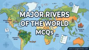
3. Which is the longest river in the world?
Correct Answer: c) Nile River
Explanation:
The Nile River in Africa is traditionally considered the longest river in the world, stretching approximately 6,650 kilometers.
4. Which is the largest hot desert in the world?
Correct Answer: b) Sahara Desert
Explanation:
The Sahara Desert in Northern Africa is the largest hot desert in the world, covering an area of about 9.2 million square kilometers.
5. Which is the highest mountain peak in the world above sea level?
Correct Answer: c) Mount Everest
Explanation:
Mount Everest, located in the Himalayas on the border of Nepal and China, is the highest mountain peak in the world at 8,848.86 meters above sea level.
6. Which is the largest freshwater lake in the world by volume?
Correct Answer: d) Lake Baikal
Explanation:
Lake Baikal in Siberia, Russia, is the world's deepest and most voluminous freshwater lake, containing about 22-23% of the world's fresh surface water.
7. Which strait separates Asia from North America?
Correct Answer: a) Bering Strait
Explanation:
The Bering Strait is a strait of the Pacific, which borders with the Arctic to the north. It is located between Russia and the United States (Alaska).
8. Which country encompasses the most time zones in the world (including its overseas territories)?
Correct Answer: c) France
Explanation:
Including its various overseas departments and territories across the globe, France spans 12 different time zones, the most of any country.
9. Which is the longest continental mountain range in the world?
Correct Answer: c) Andes
Explanation:
The Andes is the longest continental mountain range in the world, running along the western edge of South America for about 7,000 kilometers.
10. Which is the largest island in the world?
Correct Answer: d) Greenland
Explanation:
Greenland is the world's largest island, covering over 2.1 million square kilometers. Australia is classified as a continent, not an island.
11. Which is the largest and deepest ocean on Earth?
Correct Answer: c) Pacific Ocean
Explanation:
The Pacific Ocean is the largest and deepest of Earth's oceanic divisions, extending from the Arctic Ocean in the north to the Southern Ocean in the south.
12. Which is the smallest continent by land area?
Correct Answer: c) Australia
Explanation:
Australia is the smallest of the seven continents by land area, though it is often grouped with other islands to form the region of Oceania.
13. The Equator passes through how many continents?
Correct Answer: b) 3
Explanation:
The Equator passes through three continents: South America, Africa, and Asia.
14. Which is the only continent that is crossed by the Equator, the Tropic of Cancer, and the Tropic of Capricorn?
Correct Answer: c) Africa
Explanation:
Africa is unique as the only continent that is crossed by all three major lines of latitude: the Equator, the Tropic of Cancer, and the Tropic of Capricorn.
15. Which is the largest landlocked country in the world?
Correct Answer: b) Kazakhstan
Explanation:
Kazakhstan in Central Asia is the world's largest landlocked country by land area.
16. Which two countries share the longest international border in the world?
Correct Answer: c) United States and Canada
Explanation:
The border between the United States and Canada is the longest international border in the world, stretching for 8,891 kilometers.
17. Which country is estimated to have the most islands in the world?
Correct Answer: c) Sweden
Explanation:
Sweden holds the record for the most islands in the world, with an estimated count of over 260,000 islands.
18. What is the capital city of Australia?
Correct Answer: d) Canberra
Explanation:
Canberra is the capital city of Australia, chosen as a compromise location between the rival cities of Sydney and Melbourne.
19. Which is the largest freshwater lake in the world by surface area?
Correct Answer: b) Lake Superior
Explanation:
Lake Superior, located in North America between the United States and Canada, is the world's largest freshwater lake by surface area.
20. Which is the highest uninterrupted waterfall in the world?
Correct Answer: c) Angel Falls
Explanation:
Angel Falls in Venezuela is the highest uninterrupted waterfall in the world, with a height of 979 meters.
21. What is the largest coral reef system in the world?
Correct Answer: c) Great Barrier Reef
Explanation:
The Great Barrier Reef, located off the coast of Queensland, Australia, is the world's largest coral reef system.
22. Which is generally considered the driest non-polar place on Earth?
Correct Answer: b) Atacama Desert
Explanation:
The Atacama Desert in South America, primarily in Chile, is renowned as the driest non-polar desert in the world.
23. Which is the largest river delta in the world?
Correct Answer: c) Ganges-Brahmaputra Delta
Explanation:
The Ganges-Brahmaputra Delta (also known as the Sundarbans Delta) in the Bengal region of the Indian subcontinent is the world's largest river delta.
24. Which ocean is roughly 'S' shaped?
Correct Answer: b) Atlantic Ocean
Explanation:
The Atlantic Ocean has an elongated 'S' shape extending longitudinally between the Americas to the west, and Europe and Africa to the east.
25. Which mountain range separates Europe and Asia?
Correct Answer: c) Ural Mountains
Explanation:
The Ural Mountains run from north to south through western Russia and are traditionally considered the natural boundary between Europe and Asia.
26. The Strait of Gibraltar connects the Atlantic Ocean to which other body of water?
Correct Answer: c) Mediterranean Sea
Explanation:
The Strait of Gibraltar is a narrow strait that connects the Atlantic Ocean to the Mediterranean Sea and separates Europe from Africa.
27. The Suez Canal in Egypt connects the Mediterranean Sea to which body of water?
Correct Answer: a) Red Sea
Explanation:
The Suez Canal is an artificial sea-level waterway in Egypt, connecting the Mediterranean Sea to the Red Sea, enabling a more direct shipping route between Europe and Asia.
28. The Panama Canal connects the Atlantic Ocean (via the Caribbean Sea) to which other ocean?
Correct Answer: b) Pacific Ocean
Explanation:
The Panama Canal cuts across the Isthmus of Panama and serves as a vital maritime route connecting the Atlantic Ocean with the Pacific Ocean.
29. Which geographic region is known as the 'Roof of the World'?
Correct Answer: c) Pamir Knot / Tibetan Plateau
Explanation:
The Tibetan Plateau and the adjacent Pamir Mountains are frequently referred to as the 'Roof of the World' due to their immense elevation.
30. Which is the largest country in the world by land area?
Correct Answer: d) Russia
Explanation:
Russia is the largest country in the world by area, covering over 17 million square kilometers across Eastern Europe and Northern Asia.
31. Which is the smallest recognized independent state in the world by both area and population?
Correct Answer: c) Vatican City
Explanation:
Vatican City, an independent city-state enclaved within Rome, Italy, is the smallest state in the world by both area and population.
32. Which major river crosses the Equator twice?
Correct Answer: c) Congo River
Explanation:
The Congo River (formerly known as the Zaire River) in central Africa is the only major river to cross the Equator twice.
33. Which river crosses the Tropic of Capricorn twice?
Correct Answer: a) Limpopo River
Explanation:
The Limpopo River in southern Africa rises in South Africa and flows in a semi-circle, crossing the Tropic of Capricorn twice before emptying into the Indian Ocean.
34. The Yellow River (Huang He) is the second-longest river in which country?
Correct Answer: d) China
Explanation:
The Yellow River is the second-longest river in China, after the Yangtze River, and is considered the cradle of Chinese civilization.
35. Which country is historically known as the 'Land of the Rising Sun'?
Correct Answer: b) Japan
Explanation:
Japan is called the 'Land of the Rising Sun' due to its location in the far east, relative to the ancient Chinese empire, where the sun appears to rise.
36. Which country is known as the 'Land of the Midnight Sun'?
Correct Answer: c) Norway
Explanation:
Norway is called the 'Land of the Midnight Sun' because during the summer months in its northern regions (above the Arctic Circle), the sun does not set.
37. Which country is known as the 'Land of a Thousand Lakes'?
Correct Answer: b) Finland
Explanation:
Finland is affectionately known as the 'Land of a Thousand Lakes' because it has over 187,000 lakes scattered across its territory.
38. Which is the highest commercially navigable lake in the world?
Correct Answer: a) Lake Titicaca
Explanation:
Lake Titicaca, sitting on the border of Bolivia and Peru in the Andes Mountains, is the highest navigable lake in the world at an elevation of 3,812 meters.
39. What is the lowest point on dry land on Earth?
Correct Answer: b) Dead Sea shores
Explanation:
The shores of the Dead Sea, bordering Jordan, Israel, and the West Bank, represent the lowest land elevation on Earth, over 430 meters below sea level.
40. As per recent UN estimates (2023 onwards), which country is the most populous in the world?
Correct Answer: c) India
Explanation:
India has surpassed China to become the most populous country in the world, with a population exceeding 1.4 billion people.
41. Which European city is traditionally known as the 'City of Seven Hills'?
Correct Answer: b) Rome
Explanation:
Rome, the capital of Italy, is famously known as the 'City of Seven Hills' as the ancient city was built across seven distinct hills.
42. Which is the largest peninsula in the world?
Correct Answer: d) Arabian Peninsula
Explanation:
The Arabian Peninsula in Western Asia is the largest peninsula in the world, spanning over 3.2 million square kilometers.
43. Mount Etna, one of the world's most active volcanoes, is located in which country?
Correct Answer: b) Italy
Explanation:
Mount Etna is an active stratovolcano on the east coast of Sicily, Italy.
44. Which country forms the largest archipelago in the world by area and population?
Correct Answer: c) Indonesia
Explanation:
Indonesia is the world's largest archipelagic state, comprising over 17,000 islands and serving as the most populous island nation.
45. Which imaginary line divides the Earth into the Northern and Southern Hemispheres?
Correct Answer: b) Equator
Explanation:
The Equator is the line of 0 degrees latitude that circles the Earth, exactly halfway between the North and South Poles, dividing it into two hemispheres.
46. The Prime Meridian, the line of 0 degrees longitude, passes through which observatory?
Correct Answer: b) Royal Observatory, Greenwich
Explanation:
The Prime Meridian is internationally recognized as passing through the Royal Observatory in Greenwich, London, England.
47. The International Date Line roughly corresponds to which line of longitude?
Correct Answer: d) 180 degrees
Explanation:
The International Date Line is an imaginary line of demarcation on the surface of Earth that runs from the North Pole to the South Pole and generally follows the 180-degree meridian.
48. Which is the largest bay in the world measured by its shoreline length and area?
Correct Answer: b) Bay of Bengal
Explanation:
The Bay of Bengal is the largest bay in the world by area, forming the northeastern part of the Indian Ocean.
49. Which is the largest gulf in the world?
Correct Answer: c) Gulf of Mexico
Explanation:
The Gulf of Mexico, bordered by the United States, Mexico, and Cuba, is widely considered the largest gulf in the world.
50. Which is the only sea in the world that does not have a land boundary?
Correct Answer: b) Sargasso Sea
Explanation:
The Sargasso Sea is located entirely within the Atlantic Ocean and is uniquely bounded by four ocean currents rather than by land.
51. Which is the longest river in Europe?
Correct Answer: c) Volga River
Explanation:
The Volga is the longest river in Europe, flowing through Central Russia and emptying into the Caspian Sea.
52. Which is the longest river in Asia?
Correct Answer: d) Yangtze River
Explanation:
The Yangtze River in China is the longest river in Asia and the third-longest in the world.
53. Which is the longest river system in North America?
Correct Answer: c) Missouri-Mississippi River system
Explanation:
The Missouri River is technically the longest river in North America, and it combines with the Mississippi River to form the continent's longest river system.
54. Which river is the longest in South America?
Correct Answer: b) Amazon River
Explanation:
The Amazon River is the longest river in South America and the largest in the world by discharge volume of water.
55. Mount Kilimanjaro, the highest mountain in Africa, is located in which country?
Correct Answer: c) Tanzania
Explanation:
Mount Kilimanjaro is a dormant volcano in Tanzania and is the highest peak on the African continent.
56. Mount Elbrus, the highest peak in Europe, is located in which mountain range?
Correct Answer: c) Caucasus Mountains
Explanation:
Mount Elbrus is the highest peak in Europe, located in the Caucasus Mountains in southern Russia.
57. Mount Denali (formerly Mount McKinley), the highest peak in North America, is located in which US state?
Correct Answer: d) Alaska
Explanation:
Denali is the highest mountain peak in North America, with a summit elevation of 20,310 feet above sea level, located in Alaska.
58. The Great Rift Valley, a massive geological trench, is primarily associated with which continent?
Correct Answer: b) Africa
Explanation:
The Great Rift Valley is a continuous geographic trench that runs from Lebanon in the Middle East down to Mozambique in East Africa.
59. Salar de Uyuni, the world's largest salt flat, is located in which country?
Correct Answer: c) Bolivia
Explanation:
Salar de Uyuni is the world's largest salt flat, sitting at a high elevation in the Andes in southwest Bolivia.
60. Victoria Falls, one of the largest and most famous waterfalls in the world, is located on which river?
Correct Answer: c) Zambezi River
Explanation:
Victoria Falls is located on the Zambezi River at the border between Zambia and Zimbabwe.
61. Niagara Falls sits on the international border between the United States and Canada, connecting which two Great Lakes?
Correct Answer: c) Lake Erie and Lake Ontario
Explanation:
The Niagara River flows from Lake Erie into Lake Ontario, and the famous Niagara Falls is located along this river.
62. Which is the largest man-made lake (reservoir) in the world by water volume?
Correct Answer: c) Lake Kariba
Explanation:
Lake Kariba, located on the Zambezi River between Zambia and Zimbabwe, is the world's largest artificial lake and reservoir by volume.
63. During the day, coastal regions experience a local wind that blows from the ocean towards the land. What is this called?
Correct Answer: b) Sea breeze
Explanation:
A sea breeze occurs during the day when the land heats up faster than the ocean, causing cooler air from the sea to flow inland to replace the rising warm air.
64. What are the 'Roaring Forties'?
Correct Answer: b) Strong westerly winds found in the Southern Hemisphere
Explanation:
The Roaring Forties are strong westerly winds found in the Southern Hemisphere, generally between the latitudes of 40 and 50 degrees.
65. The Gulf Stream is a powerful ocean current that originates in the Gulf of Mexico. What type of current is it?
Correct Answer: b) Warm current
Explanation:
The Gulf Stream is a strong, fast-moving, warm ocean current that originates in the Gulf of Mexico and flows into the Atlantic Ocean.
66. The Humboldt Current, which flows along the western coast of South America, is what type of ocean current?
Correct Answer: b) Cold current
Explanation:
The Humboldt Current, also known as the Peru Current, is a cold, low-salinity ocean current that flows north along the western coast of South America.
67. A tsunami is primarily caused by which of the following?
Correct Answer: c) Undersea earthquakes or volcanic eruptions
Explanation:
Tsunamis are giant sea waves caused by massive disturbances in the ocean, most commonly undersea earthquakes, volcanic eruptions, or landslides.
68. What is the name of the instrument used to record the seismic waves caused by an earthquake?
Correct Answer: d) Seismograph
Explanation:
A seismograph (or seismometer) is an instrument used to detect and record earthquakes by measuring the movement of the ground.
69. Which scale is widely used to measure the magnitude of an earthquake based on the energy released?
Correct Answer: c) Richter scale (or Moment Magnitude scale)
Explanation:
The Richter scale, and more recently the Moment Magnitude scale, are used by seismologists to measure the magnitude and energy released by an earthquake.
70. What is the outermost solid shell of the Earth called?
Correct Answer: d) Crust
Explanation:
The crust is the outermost solid shell of a rocky planet, dwarf planet, or natural satellite. On Earth, it makes up less than 1% of the planet's volume.
71. Which gas is the most abundant in the Earth's atmosphere?
Correct Answer: c) Nitrogen
Explanation:
Nitrogen is the most abundant gas in the Earth's atmosphere, making up approximately 78% of the air we breathe.
72. Which layer of the atmosphere contains the ozone layer that protects Earth from harmful UV radiation?
Correct Answer: b) Stratosphere
Explanation:
The ozone layer is located in the lower portion of the stratosphere, roughly 15 to 35 kilometers above Earth, absorbing most of the Sun's ultraviolet radiation.
73. In which layer of the Earth's atmosphere do nearly all weather phenomena occur?
Correct Answer: a) Troposphere
Explanation:
The troposphere is the lowest layer of Earth's atmosphere, and it contains approximately 75% of the atmosphere's mass and almost all of its water vapor, which drives weather.
74. Which is considered the world's largest active volcano by volume and area?
Correct Answer: c) Mauna Loa
Explanation:
Mauna Loa, located in Hawaii, is historically considered the largest active volcano on Earth in terms of both volume and surface area.
75. The 'Ring of Fire', a major area in the basin of an ocean where many earthquakes and volcanic eruptions occur, is located in which ocean?
Correct Answer: c) Pacific Ocean
Explanation:
The Ring of Fire is a path along the Pacific Ocean characterized by active volcanoes and frequent earthquakes.
76. Which country is historically nicknamed the 'Sugar Bowl of the World' due to its massive sugar production?
Correct Answer: b) Cuba
Explanation:
Historically, Cuba was nicknamed the 'Sugar Bowl of the World' because it possessed the largest sugar industry in the world.
77. Which country is affectionately known as the 'Pearl of the Indian Ocean'?
Correct Answer: c) Sri Lanka
Explanation:
Sri Lanka is known as the 'Pearl of the Indian Ocean' due to its natural beauty, precious gemstones, and its teardrop shape off the coast of India.
78. Which strait separates the Indian subcontinent from the island nation of Sri Lanka?
Correct Answer: a) Palk Strait
Explanation:
The Palk Strait is a strait between the Tamil Nadu state of India and the Jaffna District of the Northern Province of the island nation of Sri Lanka.
79. Which continent was historically referred to by Europeans as the 'Dark Continent' due to its largely unexplored interior?
Correct Answer: c) Africa
Explanation:
During the 19th century, Europeans referred to Africa as the 'Dark Continent' because much of its interior was unknown and unmapped by the outside world.
80. Which continent is often called the 'White Continent'?
Correct Answer: c) Antarctica
Explanation:
Antarctica is referred to as the 'White Continent' because it is almost entirely covered by a thick layer of ice and snow.
81. Which mountain range spans the western coast of South America?
Correct Answer: c) Andes
Explanation:
The Andes Mountains line the western edge of South America, making them the longest continental mountain range in the world.
82. Which plateau is the highest and largest in the world, often called the 'Roof of the World'?
Correct Answer: c) Tibetan Plateau
Explanation:
The Tibetan Plateau in Central Asia is the highest and largest plateau in the world, with an average elevation exceeding 4,500 meters.
83. Which major river carved the Grand Canyon in the United States?
Correct Answer: b) Colorado River
Explanation:
The Grand Canyon in Arizona was carved over millions of years by the flow of the Colorado River.
84. The Gobi Desert covers parts of which two countries?
Correct Answer: b) China and Mongolia
Explanation:
The Gobi is a vast, arid region in northern China and southern Mongolia, known for its dunes, mountains, and rare animals.
85. The Kalahari Desert is a large semi-arid sandy savanna located in which continent?
Correct Answer: d) Africa
Explanation:
The Kalahari Desert is a large basin-like plain of the interior plateau of Southern Africa, covering much of Botswana, Namibia, and South Africa.
86. The Great Victoria Desert is the largest desert in which country?
Correct Answer: c) Australia
Explanation:
The Great Victoria Desert is a sparsely populated desert area in Western Australia and South Australia, making it the largest desert in the country.
87. The geographic region known as the 'Horn of Africa' includes which set of countries?
Correct Answer: c) Somalia, Ethiopia, Eritrea, Djibouti
Explanation:
The Horn of Africa is a peninsula in East Africa that juts into the Arabian Sea and typically includes Somalia, Ethiopia, Eritrea, and Djibouti.
88. The Iberian Peninsula in southwestern Europe is primarily occupied by which two countries?
Correct Answer: b) Spain and Portugal
Explanation:
The Iberian Peninsula is dominated by Spain and Portugal, along with the microstate of Andorra and the British Overseas Territory of Gibraltar.
89. Which country is culturally and historically referred to as the 'Land of White Elephants'?
Correct Answer: c) Thailand
Explanation:
Thailand is known as the 'Land of White Elephants' because white elephants are considered sacred and a symbol of royal power in Thai culture.
90. Which country is known as the 'Land of the Thunder Dragon'?
Correct Answer: b) Bhutan
Explanation:
Bhutan is known as Druk Yul, which translates to 'Land of the Thunder Dragon', a reference to the fierce storms rolling in from the Himalayas.
91. Which two countries share the longest international land border in the world?
Correct Answer: c) United States and Canada
Explanation:
The border between the USA and Canada is the longest international border in the world, stretching roughly 8,891 kilometers.
92. Which continent is notable for having no true deserts?
Correct Answer: c) Europe
Explanation:
Europe is the only continent that does not have any major, true deserts (regions receiving extremely low precipitation with arid conditions).
93. Which of these oceans is the deepest on average?
Correct Answer: b) Pacific Ocean
Explanation:
The Pacific Ocean is not only the largest ocean but also the deepest, with an average depth of approximately 4,280 meters.
94. Lake Victoria, Africa's largest lake, is bordered by which three countries?
Correct Answer: a) Uganda, Kenya, Tanzania
Explanation:
Lake Victoria is one of the African Great Lakes and its waters are shared by Uganda, Kenya, and Tanzania.
95. What is the capital city of Canada?
Correct Answer: d) Ottawa
Explanation:
Ottawa, located in the province of Ontario, is the capital city of Canada.
96. Which is the highest capital city in the world by elevation?
Correct Answer: d) La Paz, Bolivia
Explanation:
La Paz, the administrative capital of Bolivia, is located in the Andes at an elevation of roughly 3,650 meters, making it the world's highest capital city.
97. The Strait of Malacca separates the Malay Peninsula from which large island?
Correct Answer: c) Sumatra
Explanation:
The Strait of Malacca is a narrow stretch of water between the Malay Peninsula and the Indonesian island of Sumatra, serving as a crucial global shipping lane.
98. Which country is consistently the world's largest producer of coffee?
Correct Answer: d) Brazil
Explanation:
Brazil has been the highest global producer of coffee beans for over 150 years, accounting for about a third of all global coffee production.
99. Greenwich Mean Time (GMT) is based on the Prime Meridian, which is located at what degree of longitude?
Correct Answer: a) 0 degrees
Explanation:
The Prime Meridian at Greenwich represents 0 degrees longitude, which is the baseline used to calculate the world's time zones (GMT/UTC).