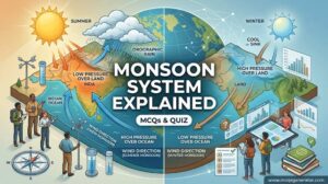
Weather and climate are foundational concepts in physical geography and earth sciences that measure atmospheric conditions over different temporal and spatial scales. While weather describes short-term, highly variable atmospheric states such as daily temperature, precipitation, and wind climate represents the long-term statistical average, variability, and extremes of weather over decades or longer. Mastering the distinction between these two phenomena is essential for meteorology, climatological modeling, environmental policy, and academic examinations. These multiple-choice questions test scientific recall, analytical reasoning, and core climatological concepts.
1. Which of the following best defines 'weather'?
Correct Answer: b) The short-term state of the atmosphere at a specific time and place
Explanation:
Weather refers to the day-to-day or even minute-to-minute changes in the atmosphere, including temperature, humidity, precipitation, and wind at a specific location.
2. Which of the following best defines 'climate'?
Correct Answer: c) The long-term pattern of weather conditions in a particular area
Explanation:
Climate is the statistical average of weather patterns over a long period, typically describing what is expected in a region based on historical data.
3. According to the World Meteorological Organization (WMO), what is the standard classical period for calculating a climate normal?
Correct Answer: b) 30 years
Explanation:
The WMO defines a 'climate normal' as a 30-year average of weather variables, which provides a benchmark to compare current weather against historical averages.
4. Complete the common meteorological adage: 'Climate is what you expect, weather is what you...'
Correct Answer: b) Get
Explanation:
This famous quote, often attributed to Robert Heinlein or Mark Twain, elegantly summarizes the difference: climate is the long-term expectation, while weather is the actual short-term reality.
5. The scientific study of the short-term state of the atmosphere is called:
Correct Answer: c) Meteorology
Explanation:
Meteorology is the branch of atmospheric sciences focused on short-term weather forecasting and the physical processes of the atmosphere.
6. The scientific study of long-term atmospheric patterns and trends is called:
Correct Answer: b) Climatology
Explanation:
Climatology is the study of climate, focusing on long-term weather patterns, average conditions, and climate change over decades, centuries, or millennia.
7. Which of the following is primarily a 'weather' forecast rather than a 'climate' projection?
Correct Answer: c) Predicting a high of 75 degrees Fahrenheit and rain for tomorrow
Explanation:
Forecasting specific conditions like temperature and precipitation for tomorrow is a short-term weather prediction.
8. What is the primary source of energy that drives both weather and climate on Earth?
Correct Answer: c) Solar radiation from the Sun
Explanation:
The Sun's radiant energy is the primary driver of the Earth's climate system and weather patterns, causing the uneven heating that drives atmospheric and oceanic circulation.
9. In which layer of the Earth's atmosphere do almost all weather and climate phenomena occur?
Correct Answer: c) Troposphere
Explanation:
The troposphere is the lowest layer of the atmosphere, containing most of its mass and water vapor, making it the layer where almost all weather occurs.
10. Which of the following statements best illustrates 'climate' rather than 'weather'?
Correct Answer: b) The Sahara Desert receives less than 10 inches of rain annually on average
Explanation:
Stating the average annual rainfall of a region over a long period describes its climate, not its day-to-day weather.
11. Which meteorological instrument is used to measure atmospheric pressure?
Correct Answer: b) Barometer
Explanation:
A barometer measures atmospheric pressure, a key indicator for predicting short-term changes in the weather.
12. Which instrument is specifically designed to measure wind speed?
Correct Answer: a) Anemometer
Explanation:
An anemometer typically uses spinning cups to measure the speed of the wind, whereas a wind vane measures wind direction.
13. A hygrometer is an instrument used to measure:
Correct Answer: c) Relative humidity
Explanation:
Hygrometers are used to measure the moisture content or relative humidity in the atmosphere.
14. What is the function of a Stevenson screen in a weather station?
Correct Answer: b) To shield temperature-measuring instruments from direct sunlight and precipitation while allowing air to circulate
Explanation:
A Stevenson screen is a louvered wooden box painted white. It ensures that thermometers measure the actual air temperature without being heated directly by the sun.
15. Meteorologists use a radiosonde primarily to:
Correct Answer: c) Collect atmospheric data (temperature, pressure, humidity) at high altitudes via a weather balloon
Explanation:
A radiosonde is an instrument carried into the atmosphere by a weather balloon to measure various atmospheric parameters and transmit them back to Earth.
16. Which instrument is used to measure the amount of incoming solar radiation (insolation)?
Correct Answer: a) Pyranometer
Explanation:
A pyranometer is a type of actinometer used for measuring solar irradiance on a planar surface, helping climatologists track solar energy inputs.
17. A ceilometer is commonly used at airports and weather stations to measure:
Correct Answer: a) The height of a cloud base or cloud ceiling
Explanation:
A ceilometer uses a laser or other light source to determine the height of a cloud base, which is crucial for aviation weather reporting.
18. Doppler radar is a critical tool for meteorologists because it can detect:
Correct Answer: b) Precipitation intensity as well as the motion (velocity) of rain and wind within a storm
Explanation:
Doppler radar measures the shift in the frequency of a radar beam (Doppler effect) to determine how fast precipitation is moving toward or away from the radar, helping to identify tornadoes and severe winds.
19. The total amount of precipitation over a specific period is traditionally measured using a:
Correct Answer: a) Rain gauge
Explanation:
A rain gauge is a simple instrument used to gather and measure the amount of liquid precipitation over an area in a predefined period.
20. In climatology, proxy data is used to understand past climates. Which of the following is NOT an example of proxy data?
Correct Answer: c) Real-time satellite temperature readings
Explanation:
Satellite readings are direct observational data of current weather/climate. Proxy data refers to preserved physical characteristics of the environment that stand in for direct measurements, like tree rings and ice cores.
21. How does latitude primarily affect a region's climate?
Correct Answer: b) It dictates the angle at which solar radiation strikes the Earth, affecting temperature
Explanation:
Locations closer to the equator (lower latitudes) receive more direct sunlight and are warmer, while locations near the poles (higher latitudes) receive sunlight at a slant and are colder.
22. The general rule regarding altitude and temperature in the troposphere is that:
Correct Answer: c) Temperature decreases as altitude increases
Explanation:
In the troposphere, the temperature generally decreases with an increase in altitude at an average rate known as the environmental lapse rate.
23. The 'continentality' effect describes how:
Correct Answer: b) Inland areas experience greater temperature extremes than coastal areas
Explanation:
Water has a higher specific heat capacity than land, meaning it heats and cools slowly. Therefore, coastal areas have milder climates, while inland (continental) areas experience extreme temperature shifts.
24. What is the 'rain shadow effect'?
Correct Answer: b) A dry area on the leeward side of a mountainous area, where mountains block the passage of rain-producing weather systems
Explanation:
As moist air is forced up a mountain (windward side), it cools and precipitates. By the time it descends on the other side (leeward side), it is dry, creating a 'rain shadow' desert.
25. Which ocean current is responsible for keeping the climate of Western Europe significantly milder than other regions at the same latitude?
Correct Answer: b) The Gulf Stream (and North Atlantic Drift)
Explanation:
The Gulf Stream is a warm ocean current that transports tropical heat from the Gulf of Mexico across the Atlantic, dramatically warming the climate of Western Europe.
26. The term 'albedo' refers to:
Correct Answer: c) The reflectivity of a surface, affecting how much solar energy is absorbed or bounced back into space
Explanation:
Albedo is a measure of reflectivity. High albedo surfaces (like snow and ice) reflect most sunlight, keeping the area cool, while low albedo surfaces (like asphalt or dark oceans) absorb heat.
27. Why does water heat up and cool down much slower than land?
Correct Answer: b) Water has a much higher specific heat capacity than land
Explanation:
Water requires more energy to raise its temperature by one degree than soil or rock does. This high specific heat acts as a climate buffer for coastal regions.
28. How do prevailing winds affect a region's climate?
Correct Answer: b) They transport heat and moisture from one region to another, dictating patterns of rainfall and temperature
Explanation:
Prevailing winds (like the Westerlies or Trade Winds) carry air masses that dictate the general moisture and temperature characteristics of the regions they blow across.
29. The Earth's axial tilt (approximately 23.5 degrees) is primarily responsible for:
Correct Answer: c) The changing of the seasons and long-term climate cycles
Explanation:
The tilt of the Earth causes different hemispheres to receive varying amounts of direct sunlight throughout the year, generating the seasons, which are a major component of a region's climate.
30. Which of the following describes how vegetation cover can affect local climate?
Correct Answer: c) Through transpiration and shading, dense vegetation generally cools the local environment and increases humidity
Explanation:
Plants release water vapor through transpiration, which absorbs latent heat and cools the air. They also provide shade, reducing the amount of solar radiation that hits the ground.
31. What happens when a cold front moves into an area occupied by a warm air mass?
Correct Answer: b) The cold air wedges under the warm air, forcing it up rapidly, often causing thunderstorms and heavy precipitation
Explanation:
Because cold air is denser, it undercuts the warm air, lifting it quickly. This rapid uplift causes the moisture in the warm air to condense quickly, often leading to severe weather.
32. A warm front is typically characterized by:
Correct Answer: a) Warm air advancing and rising gradually over cooler air, usually producing prolonged, light-to-moderate precipitation
Explanation:
Warm air is less dense than cold air, so it slides gently up and over the retreating cold air mass, leading to widespread, steady precipitation rather than violent storms.
33. When a cold front overtakes a warm front, forcing the warm air entirely off the ground, it forms a(n):
Correct Answer: b) Occluded front
Explanation:
An occluded front occurs during the mature stage of a mid-latitude cyclone when the faster-moving cold front catches up to the warm front, lifting the warm sector completely off the surface.
34. If two air masses meet but neither is strong enough to push the other out of the way, the boundary is known as a:
Correct Answer: a) Stationary front
Explanation:
A stationary front occurs when a cold air mass and a warm air mass meet, but there is little to no horizontal movement. This can result in days of cloudy, wet weather.
35. In meteorology, an air mass designated as 'mT' (Maritime Tropical) would be:
Correct Answer: d) Warm and humid
Explanation:
The 'm' stands for maritime (originating over water, thus humid), and the 'T' stands for tropical (originating near the equator, thus warm).
36. An air mass designated as 'cP' (Continental Polar) would bring what type of weather?
Correct Answer: b) Cold and dry
Explanation:
The 'c' stands for continental (forming over land, thus dry), and 'P' stands for polar (forming in high latitudes, thus cold).
37. High-pressure systems (anticyclones) are generally associated with:
Correct Answer: b) Sinking air, clear skies, and stable weather conditions
Explanation:
In a high-pressure system, air sinks and compresses, which prevents clouds from forming, generally leading to fair, calm weather.
38. Low-pressure systems (cyclones) are generally associated with:
Correct Answer: c) Rising air, cloud formation, and precipitation
Explanation:
In a low-pressure system, air converges at the surface and rises. As it rises, it cools and condenses, forming clouds and precipitation.
39. The Coriolis effect causes winds in the Northern Hemisphere to be deflected to the:
Correct Answer: b) Right
Explanation:
Due to the Earth's rotation, freely moving objects, including wind, are deflected to the right of their path of motion in the Northern Hemisphere (and to the left in the Southern Hemisphere).
40. Narrow bands of very strong winds located high in the troposphere that steer weather systems are called:
Correct Answer: c) Jet streams
Explanation:
Jet streams are fast-flowing, narrow, meandering air currents in the upper atmospheres of some planets, including Earth, which strongly influence daily weather patterns.
41. The Köppen climate classification system primarily categorizes climates based on:
Correct Answer: a) Average monthly and annual temperature and precipitation
Explanation:
Developed by Wladimir Köppen, this widely used system classifies the world's climates based mainly on long-term temperature and precipitation data, correlating them with native vegetation.
42. In the Köppen system, 'Group A' climates are characterized by:
Correct Answer: b) Tropical conditions where all twelve months have mean temperatures above 18°C (64°F)
Explanation:
Group A climates are Tropical Climates, known for their constant high temperatures and, in many cases, abundant rainfall.
43. Which Köppen climate group represents Dry (arid and semi-arid) climates where potential evaporation exceeds precipitation?
Correct Answer: b) Group B
Explanation:
Group B represents Dry Climates, which encompass true deserts (arid) and steppes (semi-arid), classified by their lack of moisture rather than temperature.
44. A Mediterranean climate, characterized by hot, dry summers and mild, wet winters, falls under which Köppen category?
Correct Answer: c) Group C (Temperate/Mesothermal)
Explanation:
The Mediterranean climate is a 'C' climate (specifically Cs), representing a temperate climate with a distinct dry summer season.
45. Group D (Continental or Microthermal) climates are typically found:
Correct Answer: c) In the interior of large landmasses in the mid-to-high latitudes of the Northern Hemisphere
Explanation:
Group D climates experience severe winters and are located deep inland away from the moderating effects of oceans, primarily in North America and Eurasia.
46. The Tundra climate, where the warmest month has an average temperature between 0°C and 10°C, is classified under which Köppen group?
Correct Answer: d) Group E
Explanation:
Group E represents Polar climates, which are subdivided into Tundra (ET) and Ice Cap (EF) climates, characterized by extreme cold.
47. What is the defining characteristic of a Tropical Rainforest (Af) climate?
Correct Answer: b) Abundant rainfall in every month of the year
Explanation:
Tropical rainforest climates have no real dry season; all months receive substantial precipitation (usually at least 60 mm), supporting dense, lush vegetation.
48. In climate classification, what does 'Group H' usually represent?
Correct Answer: b) Highland climates, where altitude dictates the climate rather than latitude
Explanation:
Group H (Highland) is used to denote complex, localized mountain climates where rapid changes in elevation create climates different from the surrounding lowlands.
49. Which of the following environments is most likely to exhibit a 'microclimate' drastically different from the general regional climate?
Correct Answer: c) A deeply shaded, damp valley floor beneath a dense forest canopy
Explanation:
A microclimate is a small, localized area where the climate differs from the surrounding area, such as the cool, humid environment under a forest canopy.
50. Which of the following locations is a classic example of a 'Steppe' (semi-arid) climate?
Correct Answer: b) The central plains of the United States (the Great Plains)
Explanation:
Steppe climates (BS in the Köppen system) are dry, grassy plains that receive more precipitation than a true desert but not enough to support a forest.
51. What is the primary defining characteristic of El Niño?
Correct Answer: b) The unusual warming of the central and eastern equatorial Pacific Ocean
Explanation:
El Niño is the warm phase of the ENSO cycle, characterized by above-average sea surface temperatures in the central and eastern tropical Pacific.
52. What is the primary defining characteristic of La Niña?
Correct Answer: a) The unusual cooling of the central and eastern equatorial Pacific Ocean
Explanation:
La Niña is the cold phase of the ENSO cycle, characterized by below-average sea surface temperatures in the central and eastern tropical Pacific.
53. What does the acronym 'ENSO' stand for?
Correct Answer: b) El Niño-Southern Oscillation
Explanation:
ENSO represents the coupled ocean-atmosphere phenomenon in the tropical Pacific, comprising the El Niño (warm phase), La Niña (cold phase), and the associated atmospheric changes (Southern Oscillation).
54. How does an El Niño event typically affect weather in the southern United States?
Correct Answer: c) It tends to bring cooler and wetter than average conditions
Explanation:
During El Niño, the Pacific jet stream moves south and east, bringing increased moisture and cooler temperatures to the southern tier of the United States.
55. The 'ocean conveyor belt' that transports heat globally through a system of deep and surface currents is scientifically known as:
Correct Answer: b) Thermohaline circulation
Explanation:
Thermohaline circulation is driven by global density gradients created by surface heat (thermo) and freshwater fluxes/salinity (haline), playing a major role in global climate.
56. Upwelling is an oceanographic phenomenon that typically leads to:
Correct Answer: b) Cold, nutrient-rich water rising to the surface, supporting abundant marine life
Explanation:
Winds blowing across the ocean surface push water away, allowing cold, nutrient-deep water to 'upwell' to the surface, which is crucial for marine ecosystems and affects local coastal climates.
57. During the day, land heats up faster than the ocean. This creates a low-pressure area over the land, causing cool air to blow in from the ocean. This weather phenomenon is known as a:
Correct Answer: b) Sea breeze
Explanation:
A sea breeze is a local, daytime wind system where cooler air from over the ocean moves inland to replace the rising warm air over the heated land.
58. At night, land cools faster than the ocean. This causes cooler air from the land to blow outward toward the warmer ocean. This is known as a:
Correct Answer: c) Land breeze
Explanation:
A land breeze occurs at night when the thermal characteristics of land and water reverse, causing the relatively cooler, denser air over the land to flow toward the lower pressure over the warmer ocean.
59. Which of the following is defined as a seasonal reversing wind accompanied by corresponding changes in precipitation, largely affecting the Indian subcontinent?
Correct Answer: c) Monsoon
Explanation:
A monsoon is a seasonal shift in the prevailing wind direction, which brings a distinct wet season (summer monsoon) and a dry season (winter monsoon), most famously in South Asia.
60. What climate phenomenon is the Indian Ocean Dipole (IOD) most analogous to?
Correct Answer: b) The El Niño-Southern Oscillation (ENSO) in the Pacific
Explanation:
The IOD is an irregular oscillation of sea-surface temperatures in the Indian Ocean, similar in its mechanism and climate impacts to ENSO in the Pacific.
61. Which of the following is strictly a severe weather event, rather than a climate phenomenon?
Correct Answer: b) A Category 5 Hurricane
Explanation:
A hurricane is an intense, short-term atmospheric disturbance (weather). The other options represent long-term climate changes or trends.
62. A rapidly rotating column of air extending from a thunderstorm to the ground is a:
Correct Answer: c) Tornado
Explanation:
Tornadoes are violently rotating columns of air that touch the ground, representing one of the most intense and localized severe weather events.
63. What is the primary difference between a hurricane, a typhoon, and a cyclone?
Correct Answer: b) The geographic location where they occur
Explanation:
They are the exact same meteorological phenomenon (tropical cyclones). They are called hurricanes in the Atlantic/Northeast Pacific, typhoons in the Northwest Pacific, and cyclones in the South Pacific/Indian Ocean.
64. Which of the following represents a climate extreme rather than a short-term weather extreme?
Correct Answer: b) A ten-year megadrought in the American Southwest
Explanation:
A megadrought extending over a decade represents a shift or extreme in long-term patterns, making it a climate phenomenon.
65. A period of unusually hot weather that lasts for several days or weeks is known as a:
Correct Answer: a) Heatwave
Explanation:
A heatwave is a prolonged period of excessively hot weather, which may be accompanied by high humidity. It is considered a severe weather event.
66. A localized column of sinking air within a thunderstorm that can cause severe wind damage similar to a tornado is called a:
Correct Answer: b) Microburst
Explanation:
A microburst is a sudden, powerful, localized downdraft that hits the ground and spreads out, causing significant wind damage.
67. Which of the following best describes an 'atmospheric river'?
Correct Answer: a) A long, narrow region in the atmosphere that transports most of the water vapor outside of the tropics
Explanation:
Atmospheric rivers are massive, flowing columns of condensed water vapor in the atmosphere responsible for producing significant levels of rain and snow, especially along the US West Coast.
68. A severe snowstorm characterized by strong winds and low visibility lasting for an extended period is a:
Correct Answer: b) Blizzard
Explanation:
A blizzard is a severe weather event defined not just by snow, but by strong winds (usually over 35 mph) and severely reduced visibility for at least 3 hours.
69. What is a 'derecho'?
Correct Answer: b) A widespread, long-lived, straight-line wind storm associated with a fast-moving band of severe thunderstorms
Explanation:
A derecho is a severe weather event characterized by intense, straight-line winds caused by a bow echo or squall line of thunderstorms.
70. The phenomenon where a region experiences a prolonged shortage in its water supply, whether atmospheric, surface water, or ground water, is known as a:
Correct Answer: a) Drought
Explanation:
Drought is an extended period of deficient precipitation resulting in a water shortage. While it starts as a weather event, prolonged droughts are studied as climate variability.
71. What is the primary mechanism of the Greenhouse Effect?
Correct Answer: b) Atmospheric gases allow shortwave solar radiation to pass through, but absorb and re-radiate outgoing longwave terrestrial radiation
Explanation:
The Earth is warmed by the sun and re-emits heat as infrared (longwave) radiation. Greenhouse gases trap this outgoing heat, keeping the planet warm.
72. Which of the following gases is the most significant contributor to anthropogenic (human-caused) global warming?
Correct Answer: c) Carbon Dioxide (CO2)
Explanation:
While water vapor is the most abundant natural greenhouse gas, Carbon Dioxide is the primary greenhouse gas emitted through human activities (fossil fuel burning) driving current climate change.
73. How does 'global warming' fundamentally differ from 'climate change'?
Correct Answer: b) Global warming refers only to the long-term rise in Earth's average temperature, while climate change encompasses global warming and its broader effects (like changes in precipitation and sea level rise)
Explanation:
Global warming is a specific aspect of climate change. Climate change is the broader term that includes warming as well as shifting weather patterns, melting ice, and rising sea levels.
74. The scientific study of climates of the geologic past is known as:
Correct Answer: a) Paleoclimatology
Explanation:
Paleoclimatology is the study of past climates using proxy data like ice cores, tree rings, and sediment layers to understand Earth's climate history.
75. The famous graph that displays the continuous accumulation of atmospheric carbon dioxide measured at the Mauna Loa Observatory since 1958 is known as the:
Correct Answer: b) Keeling Curve
Explanation:
Named after Charles David Keeling, this curve is a foundational piece of evidence in climate science demonstrating the steady increase in atmospheric CO2 concentrations.
76. The 'Urban Heat Island' effect refers to:
Correct Answer: b) The phenomenon where urban areas are significantly warmer than their surrounding rural areas due to human activities and modifications to land surfaces
Explanation:
Concrete, asphalt, and buildings in cities absorb and retain heat better than natural vegetation, creating a localized warmer climate (microclimate).
77. Which theory explains long-term natural climate changes (like Ice Ages) through variations in the Earth's orbit, axial tilt, and precession?
Correct Answer: c) Milankovitch Cycles
Explanation:
Milutin Milankovitch proposed that cyclical changes in Earth's orbital eccentricity, axial tilt (obliquity), and precession affect the distribution of solar radiation, driving glacial cycles.
78. What is 'ocean acidification', a major consequence of climate change?
Correct Answer: b) The ongoing decrease in the pH of the Earth's oceans, caused by the uptake of carbon dioxide from the atmosphere
Explanation:
As the ocean absorbs increasing amounts of anthropogenic CO2, it forms carbonic acid, which lowers the pH of the water, threatening marine life like corals and shellfish.
79. A sudden, temporary release of greenhouse gases from melting permafrost that accelerates global warming is an example of a:
Correct Answer: b) Positive feedback loop
Explanation:
A positive feedback loop occurs when a change in the system is amplified. Melting permafrost releases methane, causing more warming, which melts more permafrost.
80. Which of the following is considered an 'aerosol' that generally has a cooling effect on the global climate?
Correct Answer: b) Sulfur dioxide particles from volcanic eruptions
Explanation:
Volcanic aerosols, particularly sulfate particles, reflect incoming solar radiation back into space, temporarily cooling the Earth's climate.
81. What does 'WMO' stand for in the context of weather and climate?
Correct Answer: a) World Meteorological Organization
Explanation:
The WMO is a specialized agency of the United Nations responsible for promoting international cooperation on atmospheric science, climatology, and hydrology.
82. The leading international body for the assessment of climate change, created by the UN, is the:
Correct Answer: c) IPCC (Intergovernmental Panel on Climate Change)
Explanation:
The IPCC provides objective, scientific views of climate change, its natural, political, and economic impacts, and possible response options.
83. In the United States, which federal agency is primarily responsible for weather forecasting and oceanic/atmospheric research?
Correct Answer: b) NOAA (National Oceanic and Atmospheric Administration)
Explanation:
NOAA, which houses the National Weather Service (NWS), focuses on the conditions of the oceans, major waterways, and the atmosphere.
84. In meteorology, the 'synoptic scale' refers to:
Correct Answer: b) Large-scale weather systems like extra-tropical cyclones and high-pressure areas that span hundreds to thousands of kilometers
Explanation:
The synoptic scale deals with large weather phenomena, typically visible on a standard national or continental weather map.
85. A 'microclimate' refers to:
Correct Answer: b) The climate of a small, specific place within an area that differs from the general regional climate
Explanation:
Microclimates occur in highly localized areas, such as the shaded floor of a forest, a city street, or the north face of a mountain.
86. A 'mesoclimate' encompasses an area sized roughly comparable to:
Correct Answer: b) A large valley, a city, or a coastal region (several kilometers to tens of kilometers)
Explanation:
Mesoclimate is the scale between microclimate and macroclimate, dealing with topographically or geographically distinct regions like a metropolitan area.
87. What is Numerical Weather Prediction (NWP)?
Correct Answer: b) Using mathematical models of the atmosphere and oceans to predict the weather based on current conditions
Explanation:
NWP relies on supercomputers to run complex physical equations simulating the atmosphere, creating the modern weather forecasts we rely on.
88. Which of the following is a key input parameter for running accurate weather forecasting models?
Correct Answer: a) Current atmospheric data (initial conditions) gathered from satellites, radiosondes, and surface stations
Explanation:
Because weather is a chaotic system, models require highly accurate real-time data (initial conditions) to solve equations and predict future states.
89. The 'butterfly effect' in meteorology (chaos theory) suggests that:
Correct Answer: b) Small, unmeasured variations in the initial state of the atmosphere can lead to massive differences in the long-term weather forecast
Explanation:
Edward Lorenz coined the term to explain why weather forecasting beyond a week or two is extremely difficult; tiny errors in initial data multiply over time.
90. The National Hurricane Center (NHC) focuses heavily on which meteorological parameter to predict hurricane intensification?
Correct Answer: b) Sea Surface Temperatures (SST)
Explanation:
Hurricanes draw their energy from the latent heat of evaporation from warm ocean waters. Thus, monitoring SST is critical for predicting hurricane strength.
91. Read the statement: 'It rained exactly 4 inches in Miami yesterday.' Does this describe weather or climate?
Correct Answer: a) Weather
Explanation:
This describes a specific, short-term atmospheric event at a specific time and location, which is the definition of weather.
92. Read the statement: 'The Sahara is generally hot and arid throughout the year.' Does this describe weather or climate?
Correct Answer: b) Climate
Explanation:
This describes the long-term, expected atmospheric conditions of a large region, which defines its climate.
93. Read the statement: 'A strong cold front will bring snow to the region next Tuesday.' Does this describe weather or climate?
Correct Answer: a) Weather
Explanation:
A forecast predicting specific atmospheric conditions (a cold front and snow) for a specific upcoming day is a weather forecast.
94. Read the statement: 'Winters in Russia are notoriously harsh and long.' Does this describe weather or climate?
Correct Answer: b) Climate
Explanation:
Describing the typical, expected conditions of a season over a long period represents the climate of that region.
95. Read the statement: 'The current temperature outside is 75°F with 50% humidity.' Does this describe weather or climate?
Correct Answer: a) Weather
Explanation:
This is a real-time observation of the atmosphere's current state, defining the present weather.
96. Read the statement: 'The average annual rainfall in Seattle over the past 50 years is roughly 38 inches.' Does this describe weather or climate?
Correct Answer: b) Climate
Explanation:
A statistical average of atmospheric data collected over decades is a direct measurement of a region's climate.
97. Read the statement: 'A Category 3 hurricane is tracking toward the coast and is expected to make landfall on Thursday.' Does this describe weather or climate?
Correct Answer: a) Weather
Explanation:
A hurricane tracking toward a specific location at a specific time is a short-term, extreme weather event.
98. Read the statement: 'The Medieval Warm Period saw unusually high temperatures across the North Atlantic region from c. 950 to c. 1250.' Does this describe weather or climate?
Correct Answer: b) Climate
Explanation:
A period lasting hundreds of years characterized by a shift in average temperatures is a historical climate epoch.
99. Read the statement: 'The barometer indicates a sudden drop in atmospheric pressure over the last two hours.' Does this describe weather or climate?
Correct Answer: a) Weather
Explanation:
A rapid, short-term change in atmospheric variables (pressure) is a weather observation indicating an approaching storm system.
100. Read the statement: 'Studies show that the frequency of Category 5 storms has increased over the past century due to rising ocean temperatures.' Does this describe a focus on weather or climate?
Correct Answer: b) Climate
Explanation:
Analyzing the frequency and statistical trends of weather events over a century to identify a shift in the system is the study of climate (climatology).