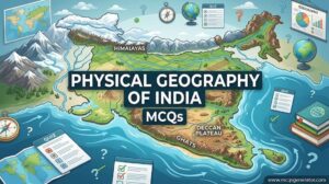
A physical map of the world illustrates the natural landscape features of the Earth, highlighting relief variations, elevation gradients, major mountain systems, vast lowland plains, desert basins, and interconnected ocean blue basins. By visualizing topography, contour lines, and bathymetry, physical maps reveal how plate tectonics, fluvial erosion, and glacial sculpting have shaped planetary landmasses over geological epochs. Mastering the identification and interpretation of these key physical features is fundamental for geomorphology, cartography, and competitive examinations. This curated collection of multiple-choice questions tests spatial reasoning, map reading, and earth science principles.
1. Which is the longest continental mountain range in the world?
Correct Answer: c) Andes
Explanation:
The Andes is the longest continental mountain range in the world, stretching along the western edge of South America for about 7,000 kilometers.
2. Which mountain range traditionally separates Europe from Asia?
Correct Answer: b) Ural Mountains
Explanation:
The Ural Mountains run from north to south through western Russia and are widely considered the natural geographical boundary between Europe and Asia.
3. The Atlas Mountains are primarily located in which part of Africa?
Correct Answer: d) North Africa
Explanation:
The Atlas Mountains are a mountain range in the Maghreb in North Africa, stretching through Morocco, Algeria, and Tunisia.
4. Which is the highest mountain peak in North America?
Correct Answer: c) Denali
Explanation:
Denali (formerly Mount McKinley), located in Alaska, is the highest mountain peak in North America, with a summit elevation of 20,310 feet.
5. The Great Dividing Range is the most substantial mountain range in which country?
Correct Answer: b) Australia
Explanation:
The Great Dividing Range is Australia's most substantial mountain range, stretching more than 3,500 kilometers along the eastern coast.
6. Mount Kilimanjaro, the highest peak in Africa, is located in which country?
Correct Answer: b) Tanzania
Explanation:
Mount Kilimanjaro is a dormant volcano in Tanzania and is the highest mountain in Africa at 5,895 meters above sea level.
7. Which mountain range forms a natural border between Spain and France?
Correct Answer: c) Pyrenees
Explanation:
The Pyrenees mountain range separates the Iberian Peninsula from the rest of Europe, serving as a natural border between Spain and France.
8. The Caucasus Mountains are located between which two bodies of water?
Correct Answer: a) Black Sea and Caspian Sea
Explanation:
The Caucasus Mountains are an intersection of Asia and Europe, stretching between the Black Sea to the west and the Caspian Sea to the east.
9. Which river is widely considered the longest in the world?
Correct Answer: c) Nile River
Explanation:
The Nile River in northeastern Africa is traditionally considered the longest river in the world, spanning approximately 6,650 kilometers.
10. The Amazon River discharges into which ocean?
Correct Answer: b) Atlantic Ocean
Explanation:
The Amazon River flows eastward across South America and discharges a massive volume of water into the Atlantic Ocean.
11. Which is the longest river in Asia?
Correct Answer: d) Yangtze River
Explanation:
The Yangtze River in China is the longest river in Asia and the third-longest in the world.
12. Which European river flows through the most countries (ten)?
Correct Answer: b) Danube
Explanation:
The Danube is Europe's second-longest river and flows through ten countries, more than any other river in the world.
13. The Volga River, the longest river in Europe, empties into which body of water?
Correct Answer: c) Caspian Sea
Explanation:
The Volga River flows through central Russia and discharges into the Caspian Sea, the world's largest inland body of water.
14. Which major river crosses the Equator twice?
Correct Answer: b) Congo River
Explanation:
The Congo River in Central Africa is the only major river in the world to cross the Equator twice.
15. The Mekong River flows through six countries. Which of the following is NOT one of them?
Correct Answer: c) Malaysia
Explanation:
The Mekong flows through China, Myanmar, Laos, Thailand, Cambodia, and Vietnam. It does not flow through Malaysia.
16. Which is the largest hot desert in the world?
Correct Answer: c) Sahara Desert
Explanation:
The Sahara, covering much of North Africa, is the world's largest hot desert and the third-largest desert overall after Antarctica and the Arctic.
17. The Atacama Desert, known as the driest non-polar desert in the world, is primarily located in which country?
Correct Answer: b) Chile
Explanation:
The Atacama Desert is located along the western coast of South America, primarily within the borders of Chile.
18. The Gobi Desert covers parts of northern China and which other country?
Correct Answer: b) Mongolia
Explanation:
The Gobi Desert is a vast, arid region in northern China and southern Mongolia.
19. The Kalahari Desert is a large semi-arid sandy savanna located in which continent?
Correct Answer: d) Africa
Explanation:
The Kalahari Desert is a large basin-like plain of the interior plateau of Southern Africa, covering parts of Botswana, Namibia, and South Africa.
20. Which North American desert spans parts of California, Nevada, Utah, and Arizona, and contains Death Valley?
Correct Answer: c) Mojave Desert
Explanation:
The Mojave Desert occupies a significant portion of southeastern California and smaller parts of central California, Nevada, Utah, and Arizona, and includes Death Valley.
21. Which is the largest enclosed inland body of water on Earth by area, often classed as the world's largest lake?
Correct Answer: b) Caspian Sea
Explanation:
The Caspian Sea is the world's largest inland body of water, often described as the world's largest lake or a full-fledged sea.
22. Which lake is the deepest and oldest freshwater lake in the world?
Correct Answer: a) Lake Baikal
Explanation:
Lake Baikal, located in Siberia, Russia, is the deepest (1,642m) and oldest (25 million years) freshwater lake in the world, holding about 22% of the world's fresh surface water.
23. Lake Victoria, Africa's largest lake, is bordered by which three countries?
Correct Answer: a) Uganda, Kenya, Tanzania
Explanation:
Lake Victoria is one of the African Great Lakes and its waters are shared by Uganda, Kenya, and Tanzania.
24. Which is the highest commercially navigable lake in the world?
Correct Answer: a) Lake Titicaca
Explanation:
Lake Titicaca, straddling the border between Peru and Bolivia in the Andes, sits at 3,812 meters, making it the highest commercially navigable lake.
25. The Aral Sea, once the fourth largest lake in the world, lies on the border between which two countries?
Correct Answer: b) Kazakhstan and Uzbekistan
Explanation:
The Aral Sea lies between Kazakhstan in the north and Uzbekistan in the south. It has drastically shrunk since the 1960s due to Soviet irrigation projects.
26. Which strait connects the Atlantic Ocean to the Mediterranean Sea?
Correct Answer: b) Strait of Gibraltar
Explanation:
The Strait of Gibraltar is a narrow strait that connects the Atlantic Ocean to the Mediterranean Sea and separates the Iberian Peninsula in Europe from Morocco in Africa.
27. The Strait of Malacca, one of the most important shipping lanes in the world, separates the Malay Peninsula from which Indonesian island?
Correct Answer: c) Sumatra
Explanation:
The Strait of Malacca is a narrow stretch of water between the Malay Peninsula (Peninsular Malaysia) and the Indonesian island of Sumatra.
28. The Strait of Hormuz connects the Persian Gulf with which body of water?
Correct Answer: b) Gulf of Oman
Explanation:
The Strait of Hormuz is a strait between the Persian Gulf and the Gulf of Oman, providing the only sea passage from the Persian Gulf to the open ocean.
29. Which strait separates Asia from North America?
Correct Answer: a) Bering Strait
Explanation:
The Bering Strait separates the Chukchi Peninsula of the Russian Far East (Asia) from the Seward Peninsula of Alaska (North America).
30. The Bab-el-Mandeb Strait connects the Red Sea to which body of water?
Correct Answer: b) Gulf of Aden
Explanation:
Bab-el-Mandeb is a strait located between Yemen on the Arabian Peninsula, and Djibouti and Eritrea in the Horn of Africa, connecting the Red Sea to the Gulf of Aden.
31. The Bosporus Strait separates the European part of Turkey from its Asian part. It connects the Sea of Marmara with which other sea?
Correct Answer: c) Black Sea
Explanation:
The Bosporus connects the Black Sea to the Sea of Marmara, which in turn is connected to the Mediterranean via the Dardanelles.
32. Which is the highest and largest plateau in the world, often called the 'Roof of the World'?
Correct Answer: c) Tibetan Plateau
Explanation:
The Tibetan Plateau in Central Asia is the highest and largest plateau in the world, with an average elevation exceeding 4,500 meters.
33. The Deccan Plateau makes up the majority of the southern part of which country?
Correct Answer: b) India
Explanation:
The Deccan Plateau is a large plateau in western and southern India, rising to 1,000 meters in the south and encompassing a significant part of the Indian peninsula.
34. Which extensive region in South America is known for its fertile lowlands and covers parts of Argentina, Uruguay, and Brazil?
Correct Answer: c) Pampas
Explanation:
The Pampas are fertile South American lowlands covering more than 1.2 million square kilometers, primarily in Argentina, but extending into Uruguay and Brazil.
35. The Altiplano, where the Andes are at their widest, is the most extensive high plateau on Earth outside of Tibet. It is mostly located in which two countries?
Correct Answer: b) Peru and Bolivia
Explanation:
The Altiplano is located in the central Andes, occupying parts of Chile, Argentina, Bolivia, and Peru, but its bulk is in Bolivia and Peru.
36. Which peninsula in Western Asia is the largest in the world?
Correct Answer: c) Arabian Peninsula
Explanation:
The Arabian Peninsula is the world's largest peninsula, covering over 3.2 million square kilometers and containing countries like Saudi Arabia and Yemen.
37. The Iberian Peninsula is occupied primarily by which two countries?
Correct Answer: c) Spain and Portugal
Explanation:
The Iberian Peninsula is located in the extreme southwest of Europe and is predominantly occupied by Spain and Portugal.
38. Which peninsula in eastern Russia is highly active volcanically, hosting over 160 volcanoes?
Correct Answer: d) Kamchatka Peninsula
Explanation:
The Kamchatka Peninsula in the Russian Far East features a high density of volcanoes and associated volcanic phenomena, part of the Ring of Fire.
39. The Yucatan Peninsula separates the Caribbean Sea from which other body of water?
Correct Answer: b) Gulf of Mexico
Explanation:
The Yucatan Peninsula in southeastern Mexico separates the Caribbean Sea to the east from the Gulf of Mexico to the west and north.
40. The Horn of Africa, a peninsula jutting into the Arabian Sea, includes which countries?
Correct Answer: b) Somalia, Ethiopia, Eritrea, Djibouti
Explanation:
The Horn of Africa denotes the easternmost projection of the African continent, comprising Somalia, Ethiopia, Eritrea, and Djibouti.
41. Which is the largest island in the world?
Correct Answer: c) Greenland
Explanation:
Greenland is the world's largest island. Australia is technically considered a continental landmass, not an island.
42. The island of New Guinea is shared by two countries. Which are they?
Correct Answer: b) Indonesia and Papua New Guinea
Explanation:
The western half of New Guinea belongs to Indonesia (Western New Guinea), and the eastern half forms the independent state of Papua New Guinea.
43. Madagascar is separated from the African mainland by which body of water?
Correct Answer: c) Mozambique Channel
Explanation:
The Mozambique Channel is an arm of the Indian Ocean located between Madagascar and the mainland countries of Mozambique and Tanzania.
44. Which of these islands is the most populous in the world?
Correct Answer: c) Java
Explanation:
Java in Indonesia is the most populous island in the world, with a population exceeding 150 million people.
45. Borneo is unique because it is the only island in the world administered by three countries. Which three?
Correct Answer: a) Indonesia, Malaysia, and Brunei
Explanation:
Borneo is divided among three countries: Malaysia and Brunei in the north, and Indonesia to the south.
46. Baffin Island, the fifth largest island in the world, is located in which country?
Correct Answer: c) Canada
Explanation:
Baffin Island is located in the Canadian territory of Nunavut and is the largest island in Canada.
47. Which ocean is the largest and deepest on Earth?
Correct Answer: c) Pacific Ocean
Explanation:
The Pacific Ocean covers more than 30% of the Earth's surface and contains the Mariana Trench, the deepest part of the world's oceans.
48. The Southern Ocean surrounds which continent?
Correct Answer: b) Antarctica
Explanation:
The Southern Ocean comprises the southernmost waters of the World Ocean, encircling Antarctica.
49. Which is the smallest and shallowest of the world's five major oceans?
Correct Answer: d) Arctic Ocean
Explanation:
The Arctic Ocean is the smallest and shallowest of the world's five major oceans, mostly covered by sea ice throughout the year.
50. The Mediterranean Sea is almost completely enclosed by land: Europe to the north, Africa to the south, and which region to the east?
Correct Answer: b) Asia
Explanation:
The Mediterranean is bounded by Europe to the north, Africa to the south, and Asia (specifically Western Asia/the Levant) to the east.
51. Which sea is located between Great Britain and the Scandinavian Peninsula?
Correct Answer: c) North Sea
Explanation:
The North Sea is a marginal sea of the Atlantic Ocean located between Great Britain, Scandinavia, Germany, the Netherlands, Belgium, and France.
52. The Caribbean Sea is a sea of which major ocean?
Correct Answer: b) Atlantic Ocean
Explanation:
The Caribbean Sea is a sea of the Atlantic Ocean in the tropics of the Western Hemisphere.
53. Which is the deepest known point in the Earth's seabed?
Correct Answer: c) Challenger Deep
Explanation:
The Challenger Deep, located at the southern end of the Mariana Trench, is the deepest known point in the Earth's seabed, at nearly 11,000 meters.
54. The Mid-Atlantic Ridge is a prime example of which type of plate boundary?
Correct Answer: b) Divergent boundary
Explanation:
The Mid-Atlantic Ridge is a mid-ocean ridge, a divergent tectonic plate boundary located along the floor of the Atlantic Ocean where tectonic plates are moving apart.
55. The 'Ring of Fire' is a region around much of the rim of which ocean where many volcanic eruptions and earthquakes occur?
Correct Answer: c) Pacific Ocean
Explanation:
The Ring of Fire is a path along the Pacific Ocean characterized by active volcanoes and frequent earthquakes.
56. The Great Barrier Reef, the world's largest coral reef system, is located off the coast of which country?
Correct Answer: c) Australia
Explanation:
The Great Barrier Reef is located in the Coral Sea, off the coast of Queensland, Australia.
57. The San Andreas Fault, a major geological fault in California, is an example of which type of plate boundary?
Correct Answer: a) Transform boundary
Explanation:
The San Andreas Fault is a continental transform fault that forms the tectonic boundary between the Pacific Plate and the North American Plate.
58. Which is the largest gulf in the world?
Correct Answer: b) Gulf of Mexico
Explanation:
The Gulf of Mexico is the largest gulf in the world, largely surrounded by the North American continent.
59. Which sea has no land boundaries and is defined entirely by ocean currents?
Correct Answer: b) Sargasso Sea
Explanation:
The Sargasso Sea is a region of the Atlantic Ocean bounded by four currents forming an ocean gyre, making it the only sea without a land boundary.
60. The lowest point on dry land is the shoreline of which body of water?
Correct Answer: c) Dead Sea
Explanation:
The shores of the Dead Sea, located between Jordan, Israel, and the West Bank, represent the lowest land elevation on Earth, over 430 meters below sea level.
61. Which of these rivers does NOT flow into the Mediterranean Sea?
Correct Answer: d) Danube
Explanation:
The Danube flows eastwards through Central and Eastern Europe and empties into the Black Sea, not the Mediterranean.
62. Which desert is known for having the highest sand dunes in the world, particularly in the Namib-Naukluft National Park?
Correct Answer: b) Namib Desert
Explanation:
The Namib Desert in coastal Namibia features some of the tallest sand dunes in the world, reaching over 300 meters high.
63. The Apennine Mountains run down the center of which peninsula?
Correct Answer: c) Italian Peninsula
Explanation:
The Apennines or Apennine Mountains consist of parallel smaller chains extending roughly 1,200 km along the length of peninsular Italy.
64. Which prominent mountain range runs across the center of Europe, covering parts of France, Switzerland, Italy, and Austria?
Correct Answer: b) Alps
Explanation:
The Alps are the highest and most extensive mountain range system that lies entirely in Europe, stretching across eight Alpine countries.
65. The vast Eurasian Steppe extends from Hungary to which eastern country?
Correct Answer: b) China
Explanation:
The Eurasian Steppe is a vast ecoregion covering the temperate grasslands, savannas, and shrublands extending from Eastern Europe (Hungary) to Manchuria (China).
66. Which body of water separates the island of Madagascar from the African mainland?
Correct Answer: c) Mozambique Channel
Explanation:
The Mozambique Channel is an arm of the Indian Ocean located between the Southeast African countries of Madagascar and Mozambique.
67. The Victoria Falls are formed by the plunging waters of which river?
Correct Answer: b) Zambezi
Explanation:
Victoria Falls is a spectacular waterfall located on the Zambezi River at the border between Zambia and Zimbabwe.
68. What is the primary geological origin of the Hawaiian Islands?
Correct Answer: c) Hotspot volcanism
Explanation:
The Hawaiian Islands were formed by volcanic activity originating from a stationary mantle plume or 'hotspot' as the Pacific Plate moved northwest over it.
69. Which river forms part of the border between the United States and Mexico?
Correct Answer: b) Rio Grande
Explanation:
The Rio Grande (known as the Río Bravo in Mexico) forms a significant portion of the international border between the US (Texas) and Mexico.
70. Which of these physical features covers the majority of the continent of Antarctica?
Correct Answer: b) Ice Sheet
Explanation:
The Antarctic Ice Sheet covers about 98% of the Antarctic continent and is the largest single mass of ice on Earth.
71. The Scandinavian Peninsula is predominantly shared by which two countries?
Correct Answer: c) Norway and Sweden
Explanation:
The Scandinavian Peninsula in Northern Europe comprises the mainland of Sweden, the mainland of Norway, and the northwestern area of Finland.
72. The Drake Passage separates South America from which continent?
Correct Answer: c) Antarctica
Explanation:
The Drake Passage is the body of water between South America's Cape Horn and the South Shetland Islands of Antarctica.
73. The Great Rift Valley is a prominent geographical feature in which part of Africa?
Correct Answer: c) East Africa
Explanation:
The Great Rift Valley system extends from the Middle East down through East Africa, featuring major lakes and highlands.
74. Which mountain range is located in the eastern United States, stretching from Canada down to Alabama?
Correct Answer: c) Appalachian Mountains
Explanation:
The Appalachian Mountains are a system of mountains in eastern North America, stretching from Newfoundland and Labrador in Canada to central Alabama in the US.
75. Lake Baikal is uniquely known for being the world's deepest lake. In which country is it located?
Correct Answer: c) Russia
Explanation:
Lake Baikal is a massive ancient lake in the mountainous Russian region of Siberia, north of the Mongolian border.
76. Which of the following describes a 'fjord'?
Correct Answer: a) A long, deep, narrow body of water that reaches far inland, formed by glacial erosion
Explanation:
Fjords are typically found in locations where current or past glaciation extended below current sea level, such as Norway, Chile, and New Zealand.
77. Which physical feature essentially divides the continent of South America into the Amazon basin to the east and a narrow coastal strip to the west?
Correct Answer: b) Andes Mountains
Explanation:
The Andes run down the entire western coast of South America, acting as a massive barrier between the Pacific coastal plains and the interior basins like the Amazon.
78. The Anatolian Peninsula, which comprises most of modern-day Turkey, is bordered by the Black Sea to the north and which sea to the south?
Correct Answer: c) Mediterranean Sea
Explanation:
The Anatolian Peninsula is bounded by the Black Sea to the north, the Mediterranean Sea to the south, and the Aegean Sea to the west.
79. Which channel separates southern England from northern France?
Correct Answer: c) English Channel
Explanation:
The English Channel is an arm of the Atlantic Ocean that separates Southern England from northern France and links to the southern part of the North Sea.
80. Which is the largest archipelago in the world by area and population?
Correct Answer: c) Malay Archipelago (Indonesia)
Explanation:
The Malay Archipelago, containing Indonesia, the Philippines, and other nations, is the largest archipelago in the world by both area and population.
81. The Colorado River carved which famous geographical landmark?
Correct Answer: c) Grand Canyon
Explanation:
The Grand Canyon in Arizona, USA, is a steep-sided canyon carved by the Colorado River over millions of years.
82. The Taklamakan Desert is located within the Tarim Basin in which country?
Correct Answer: c) China
Explanation:
The Taklamakan Desert is a vast desert in southwest Xinjiang in Northwest China, bounded by the Kunlun Mountains to the south and the Pamir Mountains to the west.
83. The Patagonian Desert, the largest desert in South America, is primarily located in which country?
Correct Answer: b) Argentina
Explanation:
The Patagonian Desert is the largest desert in Argentina and the 8th largest desert in the world by area, occupying the southern part of South America.
84. Which river flows through the Grand Canyon?
Correct Answer: c) Colorado
Explanation:
The Colorado River carved the Grand Canyon over millions of years as the Colorado Plateau was uplifted.
85. Which of these African lakes is NOT part of the Great Rift Valley system?
Correct Answer: d) Lake Chad
Explanation:
Lake Chad is a historically large, shallow, endorheic lake in Africa, located in the Sahel, far to the west of the Great Rift Valley.
86. The Guiana Shield is an ancient geological formation located on which continent?
Correct Answer: b) South America
Explanation:
The Guiana Shield is a 1.7 billion-year-old Precambrian geological formation in northeast South America that forms a portion of the northern coast.
87. Which body of water is situated between the Arabian Peninsula and the Indian subcontinent?
Correct Answer: c) Arabian Sea
Explanation:
The Arabian Sea is a region of the northern Indian Ocean bounded on the north by Pakistan and Iran, on the west by the Arabian Peninsula, and on the east by India.
88. The Palk Strait separates which two landmasses?
Correct Answer: a) India and Sri Lanka
Explanation:
The Palk Strait is a strait between the Tamil Nadu state of India and the Jaffna District of the Northern Province of the island nation of Sri Lanka.
89. Which extensive mountain range runs down the length of the Italian Peninsula?
Correct Answer: b) Apennines
Explanation:
The Apennine Mountains run like a spine down the center of the Italian Peninsula.
90. What is the name of the ocean current that warms the climate of Western Europe?
Correct Answer: c) Gulf Stream
Explanation:
The Gulf Stream (and its extension, the North Atlantic Drift) brings warm water from the Gulf of Mexico across the Atlantic, significantly warming the climate of Western Europe.
91. Which of the following is a physical feature characterized by a large, flat area of land elevated high above sea level?
Correct Answer: b) Plateau
Explanation:
A plateau is a flat, elevated landform that rises sharply above the surrounding area on at least one side.
92. The 'Pamir Knot' is a term used to describe a mountainous region situated primarily in which country?
Correct Answer: b) Tajikistan
Explanation:
The Pamir Mountains, often called the Pamir Knot because several major mountain ranges radiate from it, are located primarily in Tajikistan.
93. Which river system drains the largest area of land in the world?
Correct Answer: d) Amazon River Basin
Explanation:
The Amazon River basin is the largest drainage basin in the world, covering over 7 million square kilometers, encompassing roughly 40% of South America.
94. The island of Sumatra is part of which country?
Correct Answer: c) Indonesia
Explanation:
Sumatra is one of the Sunda Islands of western Indonesia and is the largest island that is entirely within Indonesian territory.
95. Which physical feature is created when a river deposits sediment as it flows into a standing body of water like an ocean or lake?
Correct Answer: c) Delta
Explanation:
A river delta is a landform created by the deposition of sediment that is carried by a river as the flow leaves its mouth and enters slower-moving or stagnant water.
96. The Balkan Peninsula is bordered by the Adriatic Sea to the west and which sea to the east?
Correct Answer: c) Black Sea
Explanation:
The Balkan Peninsula in southeastern Europe is bordered by the Adriatic and Ionian Seas to the west, the Aegean and Marmara Seas to the south, and the Black Sea to the east.
97. Which of these islands is shared by the UK and the Republic of Ireland?
Correct Answer: b) Ireland
Explanation:
The island of Ireland is politically divided between the Republic of Ireland (an independent nation) and Northern Ireland (part of the United Kingdom).
98. The Great Artesian Basin, one of the largest and deepest artesian basins in the world, is located in:
Correct Answer: b) Australia
Explanation:
The Great Artesian Basin provides the only reliable source of freshwater through much of inland Australia.
99. Which strait connects the Gulf of Mexico to the Caribbean Sea?
Correct Answer: b) Yucatan Channel
Explanation:
The Yucatan Channel (or Straits of Yucatan) is a strait between Mexico and Cuba that connects the Caribbean Sea with the Gulf of Mexico.