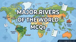
World geography general knowledge encompasses the comprehensive study of global spatial patterns, including physical landforms, oceans, continents, international boundaries, and socio-environmental distributions. Spanning all seven continents and five major ocean basins, world GK evaluates a wide spectrum of earth science facts, ranging from the highest mountain peaks and deepest trenches to major river networks and sovereign state capitals. Mastering these global metrics is essential for competitive examinations, academic tests, and broad geographic literacy. These multiple-choice questions are designed to test spatial recall, earth science fundamentals, and general knowledge proficiency.
1. Which of the world's oceans is the largest in both surface area and total volume?
Correct Answer: c) Pacific Ocean
Explanation:
The Pacific Ocean is the largest and deepest of Earth's oceanic divisions, covering more than 30% of the Earth's surface.
2. What is the longest mountain range above sea level on Earth, stretching along the western coast of South America?
Correct Answer: c) Andes
Explanation:
The Andes mountain system is the longest continental mountain range in the world, stretching over 7,000 kilometers through seven South American countries.
3. Which river is traditionally recognized as the longest river in the world?
Correct Answer: b) Nile River
Explanation:
The Nile River in northeastern Africa is traditionally measured as the longest river on Earth, flowing northward into the Mediterranean Sea.
4. Which desert is recognized as the largest hot desert in the world?
Correct Answer: c) Sahara Desert
Explanation:
The Sahara Desert in North Africa is the largest hot desert and the third-largest desert overall after Antarctica and the Arctic.
5. What is the name of the narrow strait that separates Europe from Africa and connects the Atlantic Ocean to the Mediterranean Sea?
Correct Answer: b) Strait of Gibraltar
Explanation:
The Strait of Gibraltar is a narrow passage bounded by Spain in Europe and Morocco in Africa, linking the Atlantic to the Mediterranean.
6. Which continent is known as the 'Dark Continent' historically due to its unexplored interior during early European mapping?
Correct Answer: b) Africa
Explanation:
Africa earned the historical nickname 'Dark Continent' because much of its interior remained unmapped and unexplored by Europeans until the 19th century.
7. What is the highest mountain peak in the world above sea level?
Correct Answer: c) Mount Everest
Explanation:
Mount Everest, located in the Himalayas on the border between Nepal and China (Tibet), is Earth's highest mountain at 8,848.86 meters.
8. Which imaginary line of latitude represents 0 degrees and divides the Earth into the Northern and Southern Hemispheres?
Correct Answer: b) Equator
Explanation:
The Equator is the parallel of latitude where the Earth is widest, serving as the 0-degree baseline dividing northern and southern hemispheres.
9. Which country is both an island nation and a continent, often referred to as the island continent?
Correct Answer: c) Australia
Explanation:
Australia is unique as both a sovereign nation and the world's smallest continent.
10. What is the largest freshwater lake in the world by volume, located in Russia?
Correct Answer: c) Lake Baikal
Explanation:
Lake Baikal in Siberia, Russia, holds roughly 20% of the world's unfrozen surface freshwater, making it the deepest and most voluminous freshwater lake.
11. Which canal connects the Mediterranean Sea to the Red Sea, eliminating the need to sail around the African continent?
Correct Answer: b) Suez Canal
Explanation:
The artificial sea-level waterway in Egypt, the Suez Canal, connects the Mediterranean Sea to the Red Sea for international shipping.
12. Which country has the longest coastline in the world?
Correct Answer: c) Canada
Explanation:
Canada borders three oceans (Atlantic, Pacific, Arctic) and possesses the longest coastline of any nation on Earth.
13. What is the name of the active tectonic fault zone that rings the Pacific Ocean basin, responsible for frequent earthquakes and volcanic activity?
Correct Answer: b) Ring of Fire
Explanation:
The Pacific Ring of Fire is a major area in the basin of the Pacific Ocean where many earthquakes and volcanic eruptions occur.
14. Which African country is the most populous on the continent?
Correct Answer: c) Nigeria
Explanation:
Nigeria is the most populous nation in Africa, located in West Africa along the Gulf of Guinea.
15. Which desert covers much of Mongolia and northern China, known as a cold rain shadow desert?
Correct Answer: b) Gobi Desert
Explanation:
The Gobi Desert is a large desert region in Asia covering parts of northern and northwestern China and southern Mongolia.
16. What is the deepest known oceanic trench on Earth?
Correct Answer: c) Mariana Trench
Explanation:
The Mariana Trench in the western Pacific Ocean contains the Challenger Deep, the deepest known point on Earth.
17. Which European city is built on more than 100 small islands in a lagoon in the Adriatic Sea?
Correct Answer: c) Venice
Explanation:
Venice, Italy, is world-famous for its network of canals, bridges, and historic architecture built across an archipelago of lagoon islands.
18. Which river flows through Paris, the capital of France?
Correct Answer: c) Seine
Explanation:
The Seine River is a major commercial and tourist waterway snaking through the heart of Paris, France.
19. What is the smallest independent country in the world by land area?
Correct Answer: c) Vatican City
Explanation:
Vatican City is an independent city-state enclaved within Rome, Italy, recognized as the smallest sovereign state in the world.
20. Which continent contains the geographic South Pole?
Correct Answer: c) Antarctica
Explanation:
Antarctica is Earth's southernmost continent, containing the geographic South Pole and covered overwhelmingly by an ice sheet.
21. What is the name of the imaginary line of longitude at 0 degrees passing through Greenwich, London?
Correct Answer: b) Prime Meridian
Explanation:
The Prime Meridian is the reference longitude (0 degrees) from which east and west geographic positions are measured.
22. Which South American country possesses the largest land area and population on the continent?
Correct Answer: c) Brazil
Explanation:
Brazil is the largest country in both South America and Latin America, covering nearly half of the continent.
23. Which mountain range separates Europe from Asia, running through Russia from the Arctic Ocean to Kazakhstan?
Correct Answer: b) Ural Mountains
Explanation:
The Ural Mountains form a natural geographical boundary traditionally separating Europe from the Asian continent.
24. Which ocean is the smallest and shallowest of the world's five oceans?
Correct Answer: c) Arctic Ocean
Explanation:
The Arctic Ocean surrounds the North Pole in the polar region, representing the smallest and shallowest of the world's oceans.
25. What is the capital city of Australia, often mistaken for Sydney or Melbourne?
Correct Answer: c) Canberra
Explanation:
Canberra was selected as the planned capital city of Australia during a compromise between rivals Sydney and Melbourne.
26. Which waterfall is the highest uninterrupted waterfall in the world, located in Venezuela?
Correct Answer: c) Angel Falls
Explanation:
Angel Falls in Venezuela plunges uninterrupted for nearly 979 meters from Auyan-tepui table-mountain.
27. Which US state consists entirely of an isolated volcanic island archipelago in the central Pacific Ocean?
Correct Answer: b) Hawaii
Explanation:
Hawaii is a US state comprising volcanic island chains located thousands of miles off the North American mainland in the Pacific.
28. Which country is known as the 'Land of the Midnight Sun' due to its high northern latitude causing summer sunlight at midnight?
Correct Answer: a) Norway
Explanation:
Norway experiences the midnight sun phenomenon in northern regions above the Arctic Circle during summer months.
29. What is the longest river in Europe?
Correct Answer: b) Volga River
Explanation:
The Volga River in European Russia is the longest river in Europe, emptying into the Caspian Sea.
30. Which tectonic plate boundary type is responsible for the creation of the Himalayan mountain range?
Correct Answer: c) Convergent continental-continental collision
Explanation:
The Himalayas were formed by the ongoing tectonic collision between the Indian Plate and the Eurasian Plate.
31. Which African lake is the largest tropical lake in the world and the primary source of the White Nile?
Correct Answer: b) Lake Victoria
Explanation:
Lake Victoria is Africa's largest lake by area, bordered by Tanzania, Uganda, and Kenya, serving as a reservoir for the White Nile.
32. What is the name of the wind system that brings seasonal heavy rainfall to South and Southeast Asia?
Correct Answer: b) Monsoon
Explanation:
Monsoon winds undergo complete seasonal reversals, bringing moisture-laden summer rains vital for agriculture in South Asia.
33. Which country spans across two continents (Europe and Asia), with its largest city, Istanbul, straddling the Bosporus Strait?
Correct Answer: b) Turkey
Explanation:
Turkey is a transcontinental nation situated primarily in Anatolia (Asia) with a smaller region in Southeast Europe (Thrace).
34. What is the name of the desert located in northern Chile, recognized as one of the driest places on Earth?
Correct Answer: b) Atacama Desert
Explanation:
The Atacama Desert is a plateau in South America, locked between the Andes and the Pacific Coast, experiencing extreme aridity.
35. Which island is the largest island in the world by land area, located between the Arctic and Atlantic Oceans?
Correct Answer: c) Greenland
Explanation:
Greenland is an autonomous Arctic territory of Denmark, recognized as the world's largest non-continental island.
36. Which river flows through Rome, the capital of Italy?
Correct Answer: b) Tiber River
Explanation:
The Tiber is the third-longest river in Italy, flowing directly through the historic center of Rome.
37. What is the name of the highest waterfall system on the border between Argentina and Brazil?
Correct Answer: c) Iguazu Falls
Explanation:
Iguazu Falls comprises a massive chain of waterfalls along the Iguazu River on the border of Argentina and Brazil.
38. Which country is the largest in the world by total land area?
Correct Answer: d) Russia
Explanation:
Russia is the largest country globally by land area, spanning across Eastern Europe and northern Asia.
39. What is the name of the strait that separates mainland Asia from North America (Alaska)?
Correct Answer: b) Bering Strait
Explanation:
The Bering Strait connects the Pacific and Arctic oceans, separating the US state of Alaska from Siberia, Russia.
40. Which South American country is landlocked, bordered by Brazil, Argentina, and Bolivia?
Correct Answer: b) Paraguay
Explanation:
Paraguay and Bolivia are the only two landlocked sovereign nations in South America.
41. Which mountain range forms the natural backbone of the Italian Peninsula?
Correct Answer: b) Apennines
Explanation:
The Apennine Mountains run the length of the Italian Peninsula from the northwest down to the southern toe.
42. What is the name of the massive tropical rainforest basin in South America covering over 5 million square kilometers?
Correct Answer: b) Amazon Basin
Explanation:
The Amazon Basin drains the largest tropical rainforest on Earth, spanning multiple South American nations.
43. Which African waterfall on the Zambezi River is locally known as 'Mosi-oa-Tunya' (The Smoke that Thunders)?
Correct Answer: b) Victoria Falls
Explanation:
Victoria Falls is a massive waterfall on the Zambezi River along the border between Zambia and Zimbabwe.
44. Which country in Central America connects North and South America via an isthmus containing a famous interoceanic canal?
Correct Answer: c) Panama
Explanation:
Panama is the southernmost country of Central America, spanning the isthmus that connects the North and South American continents.
45. What is the name of the cold ocean current flowing northward along the western coast of South America?
Correct Answer: b) Humboldt Current (Peru Current)
Explanation:
The Humboldt Current is a cold, nutrient-rich ocean current that flows north along the western coast of South America.
46. Which European river flows through ten different countries before emptying into the Black Sea via a massive delta?
Correct Answer: b) Danube
Explanation:
The Danube is Europe's second-longest river, passing through more capital cities and nations than any other river in the world.
47. What is the term for a chain, cluster, or collection of islands grouped together in a body of water?
Correct Answer: b) Archipelago
Explanation:
An archipelago is a group of islands closely scattered in a sea or ocean, such as Indonesia, Japan, or the Philippines.
48. Which Middle Eastern country is bordered by the Mediterranean Sea and contains the Dead Sea basin along its eastern border?
Correct Answer: b) Israel
Explanation:
Israel is situated along the southern Levant in the Middle East, sharing coastlines with the Mediterranean and the Jordan Rift Valley.
49. What is the name of the desert that covers a massive portion of southern Africa, crossing Botswana, Namibia, and South Africa?
Correct Answer: b) Kalahari Desert
Explanation:
The Kalahari Desert is a large semi-arid sandy basin in Southern Africa, home to unique wildlife and indigenous San populations.
50. Which country is the world's most populous nation, surpassing 1.4 billion residents?
Correct Answer: a) India
Explanation:
India recently surpassed China to become the world's most populous country in total inhabitants.
51. What is the name of the warm Atlantic ocean current that originates in the Gulf of Mexico and warms the climate of Western Europe?
Correct Answer: b) Gulf Stream
Explanation:
The Gulf Stream is a powerful, warm Atlantic ocean current that significantly moderates winter temperatures in Western Europe.
52. Which country in Southeast Asia is an archipelago consisting of over 17,000 islands, making it the largest island nation in the world?
Correct Answer: c) Indonesia
Explanation:
Indonesia is the world's largest archipelagic state, spanning thousands of islands across Southeast Asia and Oceania.
53. What is the highest active volcano in Europe, located on the island of Sicily in Italy?
Correct Answer: b) Mount Etna
Explanation:
Mount Etna on the east coast of Sicily is Europe's tallest active volcano and one of the most active in the world.
54. Which US state contains the geographic feature known as the Grand Canyon, carved by the Colorado River?
Correct Answer: c) Arizona
Explanation:
The Grand Canyon is a steep-sided canyon carved by the Colorado River in the state of Arizona, United States.
55. What is the name of the desert located along the southwestern coast of Africa, known for towering sand dunes meeting the Atlantic ocean?
Correct Answer: b) Namib Desert
Explanation:
The Namib Desert is a coastal desert in southern Africa famous for some of the oldest and highest sand dunes on Earth.
56. Which capital city is known as the 'Eternal City' and serves as the capital of Italy?
Correct Answer: c) Rome
Explanation:
Rome, Italy, carries the historical moniker 'Eternal City' due to its millennia-long heritage and ancient monuments.
57. What is the longest river in Asia, flowing entirely within China?
Correct Answer: c) Yangtze River (Chang Jiang)
Explanation:
The Yangtze is the longest river in Asia and the third-longest in the world, emptying into the East China Sea.
58. Which mountain range separates France from Spain across the Isthmus of Iberia?
Correct Answer: b) Pyrenees
Explanation:
The Pyrenees mountain range forms the natural border between France and Spain, dividing the Iberian Peninsula from continental Europe.
59. What is the name of the saltwater lake or inland sea situated between Israel and Jordan, known for extreme water buoyancy?
Correct Answer: c) Dead Sea
Explanation:
The Dead Sea is a hypersaline lake bordered by Jordan to the east and Israel and Palestine to the west, sitting at Earth's lowest land elevation.
60. Which country is the world's leading producer of coffee beans, accounting for a massive share of global exports?
Correct Answer: c) Brazil
Explanation:
Brazil has been the world's largest coffee producer for over 150 years, cultivating vast plantations across its southeastern highlands.
61. What is the capital of Canada?
Correct Answer: c) Ottawa
Explanation:
Ottawa is the federal capital city of Canada, located in the province of Ontario along the Ottawa River.
62. Which tectonic feature forms the deepest ocean trench in the Atlantic Ocean basin?
Correct Answer: b) Puerto Rico Trench
Explanation:
The Puerto Rico Trench is the deepest location in the Atlantic Ocean, situated on the boundary between the Caribbean Sea and the Atlantic.
63. What is the name of the desert that covers much of interior Western Australia and South Australia?
Correct Answer: b) Great Victoria Desert
Explanation:
The Great Victoria Desert is Australia's largest desert, consisting of sparse grasslands, sand ridges, and stony plains.
64. Which European country is famous for its fjords, carved by glacial activity along its rugged western coastline?
Correct Answer: c) Norway
Explanation:
Norway's coastline is heavily indented with thousands of deep glacial fjords, such as Geirangerfjord and Nærøyfjord.
65. What is the name of the famous strait separating Great Britain from continental Europe?
Correct Answer: b) English Channel (Dover Strait)
Explanation:
The English Channel, specifically the narrow Strait of Dover, separates southern England from northern France.
66. Which country is the largest producer of natural gas in the world?
Correct Answer: b) Russia
Explanation:
Russia holds the world's largest natural gas reserves and ranks among top global producers.
67. What is the capital city of Argentina?
Correct Answer: b) Buenos Aires
Explanation:
Buenos Aires is the primate port city and capital of Argentina, situated along the southern estuary of the Río de la Plata.
68. Which mountain range separates the Indian subcontinent from the Tibetan Plateau?
Correct Answer: b) Himalayas
Explanation:
The Himalayan mountain system acts as a massive climatic and geographic barrier between the Indian subcontinent and Central Asia.
69. What is the name of the largest inland body of water in the world, often classified as a saline lake or enclosed sea?
Correct Answer: b) Caspian Sea
Explanation:
The Caspian Sea is bounded by Kazakhstan, Russia, Azerbaijan, Iran, and Turkmenistan, holding the title of world's largest inland enclosed water body.
70. Which desert is located in the southwestern United States and northwestern Mexico, featuring the iconic saguaro cactus?
Correct Answer: b) Sonoran Desert
Explanation:
The Sonoran Desert is a hot North American desert spanning parts of Arizona, California, and northwestern Mexico.
71. What is the name of the river that flows through London, the capital of the United Kingdom?
Correct Answer: b) Thames
Explanation:
The River Thames flows through southern England, including central London, emptying into the North Sea.
72. Which African river is the second-longest on the continent and flows in a massive crescent shape through Central Africa?
Correct Answer: b) Congo River (Zaire River)
Explanation:
The Congo River is the deepest river in the world and the second-largest by discharge volume, draining the massive Congo rainforest basin.
73. What is the capital city of Japan, located on the island of Honshu?
Correct Answer: c) Tokyo
Explanation:
Tokyo is the bustling capital metropolis of Japan, situated in the Kantō region of Honshu island.
74. Which mountain range runs along the western coast of North America from Canada down through the western United States?
Correct Answer: b) Rocky Mountains
Explanation:
The Rocky Mountains form a major cordillera system stretching over 4,800 kilometers from western Canada down to New Mexico.
75. What is the name of the channel separating the island of Madagascar from the mainland of Southeast Africa?
Correct Answer: a) Mozambique Channel
Explanation:
The Mozambique Channel is an arm of the Indian Ocean situated between the island nation of Madagascar and East African countries.
76. Which country is the world's leading producer of crude oil and petroleum liquids?
Correct Answer: c) United States
Explanation:
Driven by hydraulic fracturing and shale oil production, the United States ranks as the world's top crude oil producer.
77. What is the capital of Egypt, situated near the Nile River Delta?
Correct Answer: c) Cairo
Explanation:
Cairo is the sprawling capital of Egypt, positioned near the Nile Delta and renowned for historic Islamic architecture and nearby Giza pyramids.
78. Which tectonic plate boundary is characterized by two plates sliding horizontally past one another, such as the San Andreas Fault?
Correct Answer: c) Transform fault boundary
Explanation:
Transform boundaries involve crustal plates grinding horizontally past each other, creating frequent seismic activity without major mountain building.
79. What is the name of the largest coral reef system in the world, located off the coast of Queensland, Australia?
Correct Answer: b) Great Barrier Reef
Explanation:
The Great Barrier Reef is composed of over 2,900 individual reefs and 900 islands off Australia's northeast coast, visible from space.
80. Which European nation is famously known as the 'Land of a Thousand Lakes' due to its vast expanse of interior lakes?
Correct Answer: c) Finland
Explanation:
Finland features over 180,000 lakes across its glaciated terrain, earning the descriptive moniker 'Land of a Thousand Lakes'.
81. What is the capital city of New Zealand?
Correct Answer: c) Wellington
Explanation:
Wellington is the political capital city of New Zealand, nestled at the southwestern tip of the North Island.
82. Which river is the longest in North America, flowing from Minnesota down to the Gulf of Mexico?
Correct Answer: c) Mississippi-Missouri River system
Explanation:
The combined Mississippi-Missouri river drainage network forms the longest river system in North America.
83. What is the name of the plateau region occupying much of central India, bordered by the Western and Eastern Ghats?
Correct Answer: b) Deccan Plateau
Explanation:
The Deccan Plateau is a large triangular tableland in peninsular India bounded by mountain ranges on its east and west flanks.
84. Which country is the smallest in South America by land area and population?
Correct Answer: b) Suriname
Explanation:
Suriname on the northeastern Atlantic coast of South America is the continent's smallest sovereign nation.
85. What is the name of the wind pattern that circumnavigates the globe near the top of the troposphere, influencing jet travel and weather?
Correct Answer: b) Jet stream
Explanation:
Jet streams are fast flowing, narrow air currents found in the upper atmosphere that steer weather systems globally.
86. Which country shares a land border with only one other nation (Canada)?
Correct Answer: b) United States
Explanation:
The contiguous United States and Alaska share their entire northern land boundary exclusively with Canada.
87. What is the capital of South Korea?
Correct Answer: b) Seoul
Explanation:
Seoul is the high-tech capital and primate metropolis of South Korea along the Han River.
88. Which desert is located in southern Argentina, forming a major cold semi-arid rain shadow desert?
Correct Answer: b) Patagonian Desert
Explanation:
The Patagonian Desert is the largest desert in Argentina, bounded by the Andes mountains and the Atlantic Ocean.
89. Which European city is situated on the banks of the Spree River and serves as the capital of Germany?
Correct Answer: c) Berlin
Explanation:
Berlin is the cultural and political capital city of Germany, built along the banks of the Spree and Havel rivers.
90. What is the name of the imaginary line at 23.30 degrees North latitude that marks the northernmost boundary where the sun can appear directly overhead?
Correct Answer: b) Tropic of Cancer
Explanation:
The Tropic of Cancer is the parallel of latitude marking the northern limit of the tropical zone where the sun is directly overhead in June.
91. Which country is the world's largest island nation situated in the Indian Ocean off the southeastern coast of Africa?
Correct Answer: b) Madagascar
Explanation:
Madagascar is the world's second-largest island country, renowned for unique endemic wildlife like lemurs.
92. What is the name of the oceanic trench located off the coast of Japan, known for intense seismic activity?
Correct Answer: b) Japan Trench
Explanation:
The Japan Trench is an oceanic trench in the northwest Pacific, part of the Pacific Ring of Fire subduction zone.
93. Which river is the longest in South America and holds the greatest water volume of any river in the world?
Correct Answer: c) Amazon River
Explanation:
The Amazon River discharges more water than the next seven largest rivers combined, draining the vast Amazon basin.
94. What is the capital city of Mexico?
Correct Answer: c) Mexico City
Explanation:
Mexico City is the densely populated capital of Mexico, built on the high plateau basin of the Valley of Mexico.
95. Which mountain range separates the Iberian Peninsula from the rest of Western Europe?
Correct Answer: b) Pyrenees
Explanation:
The Pyrenees range physically isolates the Iberian Peninsula (Spain and Portugal) from France and continental Europe.
96. What is the name of the narrow channel of water separating the island of Tasmania from the Australian mainland?
Correct Answer: b) Bass Strait
Explanation:
Bass Strait is a sea strait separating the Australian state of Victoria from the island state of Tasmania.
97. Which country in Southeast Asia was historically known as Siam until 1939?
Correct Answer: c) Thailand
Explanation:
Thailand was officially known as the Kingdom of Siam until it was renamed in 1939.
98. What is the name of the highest mountain peak in North America, located in Alaska?
Correct Answer: c) Denali (Mount McKinley)
Explanation:
Denali is the highest mountain peak in North America, located in the Alaska Range with a summit elevation of 6,190 meters.
99. Which African country is completely enclaved within the borders of South Africa?
Correct Answer: b) Lesotho
Explanation:
Lesotho is a mountainous enclave kingdom completely surrounded by the territory of South Africa.
100. What is the capital city of Italy?
Correct Answer: c) Rome
Explanation:
Rome is the capital and largest city of Italy, situated in the central Lazio region along the Tiber River.
101. Which desert is located in northern China and southern Mongolia, known for its dinosaur fossil discoveries?
Correct Answer: b) Gobi Desert
Explanation:
The Gobi Desert is famous worldwide for paleontological discoveries of dinosaur eggs and fossils embedded in its sedimentary basins.
102. What is the name of the imaginary line at 23.30 degrees South latitude that marks the southernmost boundary for the sun directly overhead?
Correct Answer: c) Tropic of Capricorn
Explanation:
The Tropic of Capricorn is the parallel of latitude marking the southern limit of the tropical zone.
103. Which country is the world's largest producer of wheat?
Correct Answer: b) China
Explanation:
China leads global wheat production, followed closely by nations like India, Russia, and the United States.
104. What is the capital city of Brazil?
Correct Answer: c) Brasilia
Explanation:
Brasilia is the planned federal capital city of Brazil, designed by architect Oscar Niemeyer and urban planner Lucio Costa.
105. Which ocean is bounded by the Americas to the west and Europe and Africa to the east?
Correct Answer: c) Atlantic Ocean
Explanation:
The Atlantic Ocean is the second-largest of the world's oceanic divisions, separating the Old World from the New World.
106. What is the name of the high-altitude plateau region often called the 'Roof of the World', located in Central Asia?
Correct Answer: c) Pamir Mountains / Tibetan Plateau
Explanation:
The Tibetan Plateau and Pamir mountain knots are historically referred to as the 'Roof of the World' due to extreme elevations.
107. Which country in South America has coastlines along both the Caribbean Sea and the Pacific Ocean?
Correct Answer: b) Colombia
Explanation:
Colombia is uniquely positioned in northwestern South America with coastlines touching both the Pacific Ocean and the Caribbean Sea.
108. What is the name of the narrow sea channel separating the Arabian Peninsula from the continent of Africa?
Correct Answer: b) Bab-el-Mandeb Strait / Red Sea
Explanation:
The Red Sea and the Bab-el-Mandeb strait separate the Horn of Africa from the Arabian Peninsula.
109. Which European river flows through Vienna, Bratislava, and Budapest before reaching the Black Sea?
Correct Answer: b) Danube
Explanation:
The Danube River flows eastward across Central and Southeastern Europe, passing through multiple major capital cities.
110. What is the capital city of Germany?
Correct Answer: c) Berlin
Explanation:
Berlin serves as the capital and largest city of the Federal Republic of Germany.
111. Which mountain range separates the Indian subcontinent from Central Asia?
Correct Answer: b) Himalayas
Explanation:
The Himalayas form the massive mountain barrier separating South Asia from the Tibetan Plateau in Central Asia.
112. What is the name of the desert located in northwestern China (Xinjiang province), known for shifting sand dunes and harsh climate?
Correct Answer: b) Taklamakan Desert
Explanation:
The Taklamakan Desert is a sandy desert in Central Asia, bounded by the Kunlun, Pamir, and Tien Shan mountain ranges.
113. Which country is the world's largest producer of tea?
Correct Answer: b) China
Explanation:
China is the world's leading producer of tea leaves, followed by India, Kenya, and Sri Lanka.
114. What is the capital of Spain, situated on a high plateau in the center of the country?
Correct Answer: c) Madrid
Explanation:
Madrid is the capital and largest city of Spain, located centrally on the Meseta Central plateau.
115. Which tectonic feature forms the deepest depression in the Indian Ocean basin?
Correct Answer: a) Java Trench (Sunda Trench)
Explanation:
The Java Trench is the deepest point in the Indian Ocean, situated off the southern coast of Sumatra and Java, Indonesia.
116. What is the name of the strait that connects the Persian Gulf to the Gulf of Oman, vital for global oil shipping?
Correct Answer: b) Strait of Hormuz
Explanation:
The Strait of Hormuz is a strategically vital chokepoint between Oman and Iran connecting the Persian Gulf to the open ocean.
117. Which African country is famous for the Serengeti National Park and Mount Kilimanjaro?
Correct Answer: b) Tanzania
Explanation:
Tanzania in East Africa boasts iconic wildlife reserves like the Serengeti and Africa's highest peak, Mount Kilimanjaro.
118. What is the capital city of France?
Correct Answer: c) Paris
Explanation:
Paris is the global cultural and political capital city of France, situated along the Seine River.
119. Which mountain range forms the natural border between European Russia and Siberia?
Correct Answer: b) Ural Mountains
Explanation:
The Ural Mountains run north-south through Russia, conventionally separating European Russia from Asian Siberia.
120. What is the name of the longest river system in Australia?
Correct Answer: b) Darling-Murray River system
Explanation:
The Murray-Darling basin forms Australia's most significant agricultural river system in the southeastern interior.
121. Which country is the world's leading producer of rice?
Correct Answer: b) China
Explanation:
China produces more rice than any other nation globally, followed by India, Indonesia, and Bangladesh.
122. What is the capital of the United Kingdom?
Correct Answer: c) London
Explanation:
London is the capital and largest city of England and the United Kingdom, situated along the River Thames.
123. Which tectonic plate collision created the European Alps mountain range?
Correct Answer: a) African Plate and Eurasian Plate collision
Explanation:
The Alps were formed by the tectonic collision between the northward-moving African Plate and the Eurasian Plate.
124. What is the name of the desert located in southwestern Turkmenistan and Uzbekistan?
Correct Answer: b) Karakum Desert
Explanation:
The Karakum Desert occupies much of Turkmenistan in Central Asia, featuring the famous Darvaza gas crater ('Door to Hell').
125. Which country is the world's largest archipelagic state by area and population?
Correct Answer: c) Indonesia
Explanation:
Indonesia spans thousands of volcanic islands across Southeast Asia, ranking as the largest island nation.